The exact coordinates of Walnut Ridge Arkansas for your GPS track:
Latitude 36.068192 North, Longitude 90.955849 West.
Please share the link with friends and neighbors:
Share on Facebook
Share on WhatsApp
Share on Telegram
Share on Facebook
Share on WhatsApp
Share on Telegram
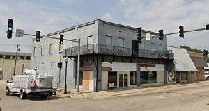
An image of Walnut Ridge
More city maps of Arkansas:
- Map of Fort Smith
Fort Smith is a city in Sebastian County, Arkansas, United States. It is the second most populous ... - Map of Conway
Conway is a city in central Arkansas with 67 thousand residents. It is the county seat of Faulkner... - Map of Bentonville
Bentonville is a city in Arkansas with 54 thousand residents. It is known as the birthplace of Wal... - Map of Bella Vista
Bella Vista, Arkansas (established in 1917) is a charming city found in Benton County. The populat... - Map of Texarkana
Texarkana, Arkansas is a wonderful city and the county seat of Miller County. Today Texarkana is p... - Map of Searcy
Searcy, Arkansas is a pleasant city and the county seat of White County. The population of Searcy ... - Map of Siloam Springs
Siloam Springs is a lovely city located in the northwest corner of Arkansas. It is part of Benton ... - Map of Harrison
Harrison is a city located in the north-central region of Arkansas. It is the county seat of Boone... - Map of Malvern
Malvern is a city located in the central region of Arkansas. It is the county seat of Hot Spring C... - Map of Greenwood
Greenwood, Arkansas is a city located in Sebastian County. It stands in the western part of the st... - Map of Hope
Hope is a wonderful city situated in Hempstead County, in southwestern Arkansas. It is known for i... - Map of Prairie Grove
Prairie Grove is a beautiful city situated in Washington County, northwest Arkansas. It is known f... - Map of Osceola
Osceola, Arkansas is a lovely city located in Mississippi County. It stands in the northeastern pa... - Map of De Queen
De Queen, Arkansas is a beautiful city situated in Sevier County. It stands in the southwestern pa...
Full list of Arkansas maps
This online map of Walnut Ridge, Arkansas is provided by Bing Maps. Please add a bookmark and share the page with your friends!