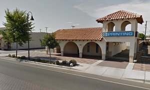
The exact coordinates of Tolleson Arizona for your GPS track:
Latitude 33.450317 North, Longitude 112.259956 West.
Share on Facebook
Share on WhatsApp
Share on Telegram
An image of Tolleson

More city maps of Arizona:
- Map of Glendale
Glendale is a city located in Maricopa County, Arizona. Glendale is known for its strong arts and ... - Map of Phoenix
Phoenix is the biggest city of Arizona and one of the most populous in the US.... - Map of Flagstaff
Flagstaff, incorporated in 1894, is a city in the northern part of Arizona, serving as the county ... - Map of Maricopa
Maricopa is a city in Pinal County of Arizona. It is actually a part of Phoenix metro area. The po... - Map of Marana
Marana is a small town in Pima County of Arizona with 50 thousand residents. It is located about 2... - Map of Sierra Vista
Sierra Vista, Arizona (incorporated in 1956) is a fascinating city found in Cochise County, about ... - Map of El Mirage
El Mirage, Arizona is an adorable city located 20 miles northwest to Phoenix, in Maricopa County. ... - Map of Fountain Hills
Fountain Hills, Arizona is a lovely town located 32 miles northeast of Phoenix, in Maricopa County... - Map of Flowing Wells
Flowing Wells is a census-designated place located in Pima County, Arizona. It is situated approxi... - Map of Tanque Verde
Tanque Verde, Arizona is a suburban community located in Pima County. It is situated approximately... - Map of Coolidge
Coolidge, Arizona is a city located in Pinal County. It is situated approximately 50 miles southea... - Map of Verde Village
Verde Village, Arizona is a census-designated place (CDP) located in Yavapai County, about 90 mile... - Map of Saddlebrooke
Saddlebrooke, Arizona is a master-planned community located in Pinal County. It is situated at the... - Map of Tuba City
Tuba City, Arizona is a charming town located in Coconino County, within the Navajo Nation, which ... - Map of Catalina
Catalina, Arizona is a beautiful CDP located in Pima County. It sits in the southern part of the s... - Map of Thatcher
Thatcher, Arizona is a charming town located in the eastern part of the state, in Graham County. T... - Map of Cave Creek
Cave Creek is a town located in Maricopa County, Arizona. It stands in the northern part of the Ph...
Full list of Arizona maps
This online map of Tolleson, Arizona is provided by Bing Maps. Please add a bookmark and share the page with your friends!
