The exact coordinates of Chula Vista California for your GPS track:
Latitude 32.640713 North, Longitude 117.081985 West.
Please share the link with friends and neighbors:
Share on Facebook
Share on WhatsApp
Share on Telegram
Share on Facebook
Share on WhatsApp
Share on Telegram
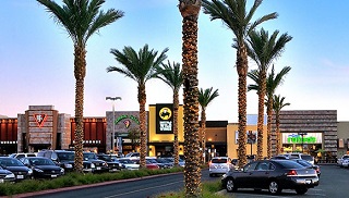
An image of Chula Vista
More city maps of California:
- Map of Oakland
Oakland is a city located in the state of California, in the United States. It stands in the San F... - Map of Santa Ana
Santa Ana is a city in Orange County, California, located approximately 35 miles south of Los Ange... - Map of Fremont
Fremont is a city in Alameda County, California. It stands near San Jose and has a population of 2... - Map of Fontana
Fontana is a city in San Bernardino county, California. It's population is close to 210 thousand p... - Map of San Francisco
San Francisco is one of the biggest cities in California. It is a major cultural and business cent... - Map of Glendale
Glendale, California is a city in Los Angeles area with almost 200 thousand inhabitants.... - Map of Oceanside
Oceanside is a midsize coastal city in southern California with 172 thousand inhabitants. During t... - Map of Palmdale
Palmdale, California is a city located to the north of Los Angeles. The population is about 165 th... - Map of Thousand Oaks
Thousand Oaks, California is a city located to the northwest of downtown Los Angeles. The populati... - Map of Simi Valley
Simi Valley, California is a large northwestern suburb of Los Angeles with 124 thousand inhabitant... - Map of Victorville
Victorville (incorporated 1962) is a city in the Victor Valley, southern California. The populatio... - Map of El Monte
El Monte, California is a city located in the San Gabriel Valley, not far away from downtown Los A... - Map of Costa Mesa
Costa Mesa (incorporated in 1953) is a city in California, located in Map of Inglewood
Inglewood, California is a southwestern suburb of Los Angeles with 111 thousand inhabitants. The c... - Map of Temecula
Temecula is a city in Riverside County, southern Cal... - Map of Murrieta
Murrieta is a young and fast growing city in California with 108 thousand inhabitants. Murrieta is... - Map of Jurupa Valley
Jurupa Valley, California is a young city in Riverside C...
Distances from Chula Vista, California:
- Distance between Chula Vista and Oakland
- Distance between Chula Vista and Santa Ana
- Distance between Chula Vista and Fremont
- Distance between Chula Vista and Fontana
- Distance between Chula Vista and San Francisco
- Distance between Chula Vista and Glendale
- Distance between Chula Vista and Oceanside
- Distance between Chula Vista and Palmdale
- Distance between Chula Vista and Thousand Oaks
- Distance between Chula Vista and Simi Valley
- Distance between Chula Vista and Victorville
- Distance between Chula Vista and El Monte
- Distance between Chula Vista and Costa Mesa
- Distance between Chula Vista and Inglewood
- Distance between Chula Vista and Temecula
- Distance between Chula Vista and Murrieta
- Distance between Chula Vista and Jurupa Valley
Full list of California maps
This online map of Chula Vista, California is provided by Bing Maps. Please add a bookmark and share the page with your friends!