The exact coordinates of Ladera Heights California for your GPS track:
Latitude 33.98333 North, Longitude 118.366669 West.
Please share the link with friends and neighbors:
Share on Facebook
Share on WhatsApp
Share on Telegram
Share on Facebook
Share on WhatsApp
Share on Telegram
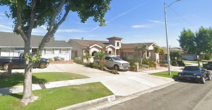
An image of Ladera Heights
More city maps of California:
- Map of Fresno
Fresno is the 5-th largest city of California, located in the central part of the state.... - Map of Rancho Cucamonga
Rancho Cucamonga is a city in California, a large suburb of San Bernardino with 175 thousand inhab... - Map of Pasadena
Pasadena, California is a city in Los Angeles County with approximately 140 thousand inhabitants. ... - Map of Roseville
Roseville AKA Junction is a city in eastern California, located north-east to Sacramento, with 128... - Map of Carlsbad
Carlsbad, California is a charter city and a popular resort in San Diego metropolitan area with 11... - Map of Fairfield
Fairfield, California (incorporated 1903) is a city with 111 thousand inhabitants, located midway ... - Map of Antioch
Antioch, California is a city located in the San Francisco Bay Area. The population of Antioch is ... - Map of Norwalk
Norwalk (incorporated 1957) is a small suburban city located 17 miles south-east to Los Angeles. T... - Map of Daly City
Daly City is a large southern suburb of San Francisco with 106 thousand inhabitants. The city was ... - Map of Compton
Compton is a southern suburb of Los Angeles with 97 thousand inhabitants. Incorporated in 1888, it... - Map of Carson
Carson, California, incorporated 1968, is a southern suburb of Los Angeles with 91 thousand inhabi... - Map of Santa Barbara
Santa Barbara, California, is a resort city located to the northwest to Los Angeles and often call... - Map of Hawthorne
Hawthorne, California is a southern suburb of Los Angeles with 86 thousand inhabitants. The city w... - Map of Chino
Chino, incorporated 1910, is a city in southern California with 90 thousand residents. It is locat... - Map of Menlo Park
Menlo Park, incorporated 1927, is one of the key cities of Silicon Valley with one of the most edu... - Map of Merced
Merced is a city in the San Joaquin Valley with 83 thousand residents. Incorporated in 1889, it is... - Map of Tustin
Tustin, California (incorporated 1927) is a city in Orange ...
Full list of California maps
This online map of Ladera Heights, California is provided by Bing Maps. Please add a bookmark and share the page with your friends!