The exact coordinates of South Monrovia Island California for your GPS track:
Latitude 34.130432 North, Longitude 117.994446 West.
Please share the link with friends and neighbors:
Share on Facebook
Share on WhatsApp
Share on Telegram
Share on Facebook
Share on WhatsApp
Share on Telegram
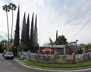
An image of South Monrovia Island
More city maps of California:
- Map of Riverside
Riverside is a city in Riverside County, California, located in the Inland Empire region of Southe... - Map of San Bernardino
San Bernardino, California is a city located in San Bernardino County, in the Inland Empire region... - Map of San Jose
San Jose is the biggest city of the Silicon Valley in California. The City is home to many famous ... - Map of Cupertino
Cupertino, CA is a small city not far from San Jose. The population of Cupertino, CA is about 58 t... - Map of Moreno Valley
Moreno Valley is a city located in the southern part of California, to the east of Los Angeles, wi... - Map of Santa Rosa
Santa Rosa is a city in the northern part of San Francisco Bay area. Its population is about 176 t... - Map of Elk Grove
Elk Grove is a large and rapidly growing suburb of Sacramento with 179 thousand inhabitants.... - Map of Salinas
Salinas is located in central California, 8 miles from the ocean coast. The population of Salinas ... - Map of Escondido
Escondido, California is a beautiful city located in the northern part of San Diego County, inland... - Map of Corona
Corona AKA The Circle City is located in Riverside Count... - Map of Visalia
Visalia is a city in central California, located in the San Joaquin Valley. Visalia is the county ... - Map of Mountain View
Mountain View is an important city in the Silicon Valley, hosting headquarters of major IT giants,... - Map of Clovis
Clovis is a large suburb of Fresno, California. The population of Clovis exceeds 100 thousand inha... - Map of Burbank
Burbank, California is a large suburb of Los Angeles with 104 thousand inhabitants. The city was i... - Map of Vacaville
Vacaville, California, incorporated 1892, is a city located in Solano County, just between San Fra... - Map of Westminster
Westminster, California is a city in Orange County with... - Map of San Leandro
San Leandro is a large suburban city of San Francisco with 85 thousand inhabitants. It is located ...
Full list of California maps
This online map of South Monrovia Island, California is provided by Bing Maps. Please add a bookmark and share the page with your friends!