The exact coordinates of Denver Colorado for your GPS track:
Latitude 39.747406 North, Longitude 104.992729 West.
ZIP codes for Denver:
80201 80202 80203 80204 80205 80206 80207 80208 80209 80210 80211 80212 80214 80215 80216 80217 80218 80219 80220 80221 80222 80223 80224 80225 80226 80227 80228 80229 80230 80231 80232 80233 80234 80235 80236 80237 80238 80239 80243 80244 80246 80247 80248 80249 80250 80251 80252 80256 80257 80259 80260 80261 80262 80263 80264 80265 80266 80271 80273 80274 80281 80290 80291 80293 80294 80299
Please share the link with friends and neighbors:
Share on Facebook
Share on WhatsApp
Share on Telegram
Share on Facebook
Share on WhatsApp
Share on Telegram
Cool facts about Denver
Why is Denver called the “Mile High City”?What is Denver most known for?
Is Denver a good city for outdoor lovers?
When is the best time to visit Denver?
How walkable is downtown Denver?
Where is Union Station in Denver and why is it so popular?
Are there any free things to do in Denver?
Is Denver a family-friendly city?
What neighborhoods are worth visiting in Denver?
How is the public transportation in Denver?
Is it true that Denver has a lot of sunshine?
Can I see the Rocky Mountains from the city?
Does Denver have a strong arts and culture scene?
Is Denver a tech-friendly city?
What is the overall vibe of Denver?
Check out some popular locations in Denver:
- McDonald's in Denver
- Starbucks in Denver
- Walmart in Denver
- Wells Fargo in Denver
- Chase Bank in Denver
- CVS in Denver
- 7-Eleven in Denver
- Gyms in Denver
- Car wash in Denver
- Real Estate agencies in Denver
- Landmarks in Denver
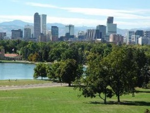
An image of Denver
More city maps of Colorado:
- Map of Colorado Springs
Colorado Springs is an awesome city located in the central part of Colorado, at the base of the Ro... - Map of Centennial
Centennial, Colorado (incorporated 2001) is a young and fast growing city located on the southern ... - Map of Loveland
Loveland, Colorado is a part of Fort Collins-Loveland conurbation. The population of Loveland is o... - Map of Castle Rock
Castle Rock, Colorado is a town, incorporated in 1881, that is located 20 miles south to downtown ... - Map of Littleton
Littleton, Colorado is a southern suburb of Denver with 45 thousand residents. It is a home rule m... - Map of Security-Widefield
Security-Widefield, Colorado is a nice suburban CDP of Colorado Springs, located in El Paso County... - Map of Pueblo West
Pueblo West, Colorado is a CDP situated about 42 miles south of Colorado Springs, in Pueblo County... - Map of Louisville
Louisville, Colorado is a charming city found 22 miles north of Denver, in Boulder County. The pop... - Map of Cañon City
Cañon City, Colorado is a charming city located in Fremont County. It stands in the central part ... - Map of Greenwood Village
Greenwood Village, Colorado is a suburban city located in Arapahoe County. It is a part of the Den... - Map of Lone Tree
Lone Tree, Colorado is an adorable suburban city located in Douglas County. It is part of the Denv... - Map of Cherry Creek
Cherry Creek is a CDP located near Denver, in Arapahoe County, Colorado. The population of Cherry ... - Map of Rifle
Rifle, Colorado is a city located in Garfield County. It is situated in the western part of the st... - Map of Fairmount
Fairmount, Colorado is an unincorporated community located in Jefferson County. It is situated clo... - Map of The Pinery
The Pinery is a residential community located in Douglas County, Colorado. It is a suburban area s... - Map of Evergreen
Evergreen, Colorado is an adorable picturesque mountain town located in Jefferson County. It is ne... - Map of Craig
Craig is a lovely city situated in Moffat County, in northwestern Colorado, approximately 40 miles...
This online map of Denver, Colorado is provided by Bing Maps. Please add a bookmark and share the page with your friends!