Fort Collins, Colorado has a rich history that dates back to the mid-19th century. The area was originally inhabited by Native American tribes, including the Arapaho and Cheyenne, before being settled by European settlers in the mid-1860s.
In 1864, the United States Army established Camp Collins in the area as a military fort to protect travelers and settlers along the Overland Trail. The fort was later abandoned in 1867, but the town that had formed around it continued to grow.
In 1873, Fort Collins was officially incorporated as a city and quickly became an important center of agriculture, particularly for sugar beet and sheep farming. The town also became known for its thriving brewery industry, with several successful breweries operating in the late 19th and early 20th centuries.
In the 20th century, Fort Collins continued to grow and diversify, becoming home to Colorado State University, a major research institution, and several large technology and manufacturing companies. Today, Fort Collins is a thriving city with a rich history, a strong economy, and a vibrant cultural scene.
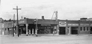
A historical image of Fort Collins
In 1864, the United States Army established Camp Collins in the area as a military fort to protect travelers and settlers along the Overland Trail. The fort was later abandoned in 1867, but the town that had formed around it continued to grow.
In 1873, Fort Collins was officially incorporated as a city and quickly became an important center of agriculture, particularly for sugar beet and sheep farming. The town also became known for its thriving brewery industry, with several successful breweries operating in the late 19th and early 20th centuries.
In the 20th century, Fort Collins continued to grow and diversify, becoming home to Colorado State University, a major research institution, and several large technology and manufacturing companies. Today, Fort Collins is a thriving city with a rich history, a strong economy, and a vibrant cultural scene.
A historical image of Fort Collins