The exact coordinates of Fort Morgan Colorado for your GPS track:
Latitude 40.251263 North, Longitude 103.801376 West.
Share on Facebook
Share on WhatsApp
Share on Telegram
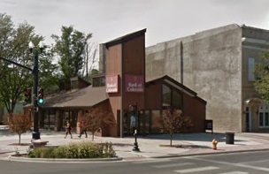
An image of Fort Morgan

More city maps of Colorado:
- Map of Parker
Parker, Colorado is a town in Douglas County with 58 thousand residents. It is a home rule municip... - Map of Englewood
Englewood, Colorado is a suburban city of Denver, found in Arapahoe County. The population of Engl... - Map of Dakota Ridge
Dakota Ridge, Colorado is a nice suburb of Denver, located in Jefferson County. Dakota Ridge is ho... - Map of Four Square Mile
Four Square Mile, Colorado is a lovely CDP located near Aurora, in Arapahoe County. Today Four Squ... - Map of Cimarron Hills
Cimarron Hills, Colorado is a census-designated place (CDP) located in El Paso County. It is part ... - Map of Firestone
Firestone, Colorado is a shining town located in Weld County. It is part of the Denver Metropolita... - Map of Sterling
Sterling, Colorado is a pleasant city located in Logan County, in the northeastern part of the sta... - Map of Edwards
Edwards, Colorado is an unincorporated community located in Eagle County. It is situated in the Va... - Map of Glenwood Springs
Glenwood Springs, Colorado is a city located in Garfield County. It is situated in the Rocky Mount... - Map of Severance
Severance is a beautiful town located in Weld County, in northern Colorado, approximately 60 miles... - Map of Timnath
Timnath is a shining town located in Larimer County, in northern Colorado, approximately 50 miles ... - Map of Derby
Derby, Colorado is a wonderful CDP found in Adams County. It is a suburban community located about... - Map of Fort Lupton
Fort Lupton, Colorado is a city located in Weld County, about 30 miles northeast of Denver, the st... - Map of Fruitvale
Fruitvale, Colorado is an adorable community and a census-designated place in Mesa County. It is s... - Map of Aspen
Aspen, Colorado is a shining town in Pitkin County. It is a world-renowned resort located in the c... - Map of Twin Lakes
Twin Lakes, Colorado is a beautiful CDP located in Adams County. It is a part of the Denver-Aurora... - Map of Sheridan
Sheridan, Colorado is a charming city found in Arapahoe County. It stands in the Denver metropolit...
Full list of Colorado maps
This online map of Fort Morgan, Colorado is provided by Bing Maps. Please add a bookmark and share the page with your friends!
