The exact coordinates of Lochbuie Colorado for your GPS track:
Latitude 40.006432 North, Longitude 104.719429 West.
Please share the link with friends and neighbors:
Share on Facebook
Share on WhatsApp
Share on Telegram
Share on Facebook
Share on WhatsApp
Share on Telegram
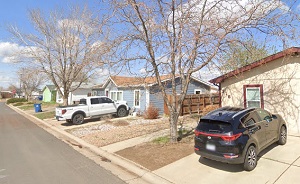
An image of Lochbuie
More city maps of Colorado:
- Map of Lakewood
Lakewood, Colorado is a western suburb of Denver with population of about 143 thousand people.... - Map of Grand Junction
Grand Junction (incorporated in 1882) is a city in western Colorado, serving as the county seat of... - Map of Windsor
Windsor, Colorado is a home rule municipality situated near Fort Collins, in Larimer County. Today... - Map of Erie
Erie, Colorado is a charming town found mostly in Weld County. The population of Erie exceeds 32 t... - Map of Columbine
Columbine, Colorado is a southern suburb of Denver located in Jefferson County. The population of ... - Map of Montrose
Montrose, Colorado is the county seat of Montrose County. Incorporated on May 1, 1882, today Montr... - Map of Golden
Golden is a historic city located in the foothills of the Rocky Mountains in Colorado. The populat... - Map of Johnstown
Johnstown, Colorado is an adorable town located in Weld County. It is a part of Denver metro area.... - Map of Frederick
Frederick, Colorado is a lovely town located in Weld County. It is a part of Denver metropolitan a... - Map of Superior
Superior, Colorado is a town located in Boulder County. It is situated in the north-central part o... - Map of Berkley
Berkley, Colorado is a census-designated place and a northern suburb of Denver, located in Adams C... - Map of Berthoud
Berthoud, Colorado is a lovely town located in Larimer and Weld counties in the state of Colorado.... - Map of Stonegate
Stonegate, Colorado is a lovely CDP located in Douglas County, approximately 25 miles southeast of... - Map of Milliken
Milliken is a beautiful town in northern Colorado, located in Weld County, approximately 50 miles ... - Map of Roxborough Park
Roxborough Park, Colorado is a picturesque and affluent residential community located in Douglas C... - Map of La Junta
La Junta is a lovely city located in Otero County, southeastern Colorado. It is known for its hist... - Map of Stratmoor
Stratmoor is a community and a CDP located in El Paso County, Colorado. It stands in the southern ...
This online map of Lochbuie, Colorado is provided by Bing Maps. Please add a bookmark and share the page with your friends!