The exact coordinates of Redlands Colorado for your GPS track:
Latitude 39.083744 North, Longitude 108.638741 West.
Please share the link with friends and neighbors:
Share on Facebook
Share on WhatsApp
Share on Telegram
Share on Facebook
Share on WhatsApp
Share on Telegram
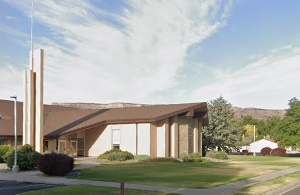
An image of Redlands
More city maps of Colorado:
- Map of Fort Collins
Fort Collins is the fourth largest city in Colorado with a population of about 168 thousand people... - Map of Thornton
Thornton, Colorado is a big northern suburb of Denver, with over 118 thousand inhabitants. The cit... - Map of Boulder
Update: at least 10 dead, including police off... - Map of Greeley
Greeley, Colorado (incorporated 1885) is a city located in Weld County, about 50 miles north to De... - Map of Longmont
Longmont, Colorado is a city founded in 1871 and now sharing the 13-th place in Colorado's most po... - Map of Broomfield
Broomfield, incorporated 1961, is a city in the central part of Colorado, a suburb of Denver. The ... - Map of Commerce City
Commerce City is a large northeastern suburb of Denver with more than 60 thousand residents. It wa... - Map of Brighton
Brighton, Colorado is the county seat of Adams County. The city's population exceeds 40 thousand r... - Map of Northglenn
Northglenn, Colorado is a master planned community found in Adams County, about 12 miles north of ... - Map of Wheat Ridge
Wheat Ridge, Colorado is a suburban municipality of Denver, located in Jefferson County. Wheat Rid... - Map of Fountain
Fountain, Colorado is a home rule municipality located 15 miles southeast of Colorado Springs, in ... - Map of Clifton
Clifton, Colorado is a CDP situated near Grand Junction, in Mesa County. Today Clifton is populate... - Map of Sherrelwood
Sherrelwood, Colorado is an unincorporated community and census-designated place located in Adams ... - Map of Fort Carson
Fort Carson is a United States Army installation located in El Paso County, Colorado, near the cit... - Map of Black Forest
Black Forest, Colorado is a rural community located in El Paso County. It is an unincorporated are... - Map of Fruita
Fruita, Colorado is a shining city located in Mesa County. It is situated in western Colorado, nea... - Map of Castle Pines
Castle Pines, Colorado is a city located in Douglas County. It is a suburban community situated in...
Full list of Colorado maps
This online map of Redlands, Colorado is provided by Bing Maps. Please add a bookmark and share the page with your friends!