The exact coordinates of Woodmoor Colorado for your GPS track:
Latitude 39.098824 North, Longitude 104.84864 West.
Please share the link with friends and neighbors:
Share on Facebook
Share on WhatsApp
Share on Telegram
Share on Facebook
Share on WhatsApp
Share on Telegram
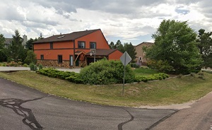
An image of Woodmoor
More city maps of Colorado:
- Map of Aurora
Aurora is a city in the U.S. state of Colorado, located in the Denver metropolitan area. It is the... - Map of Arvada
Arvada, Colorado is a part of Denver metropolitan area and the seventh largest city in the state. ... - Map of Westminster
Westminster, Colorado is a large northern suburb of Denver with 112 thousand inhabitants. Westmins... - Map of Pueblo
Pueblo is a city located in the Front Range Urban Corridor. It is a county seat of Pueblo County. ... - Map of Highlands Ranch
Highlands Ranch, Colorado is a large CDP located on the southern edge of Denver metro area. The po... - Map of Ken Caryl
Ken Caryl, Colorado is a suburban CDP of Denver, located in Jefferson County. Ken Caryl is home to... - Map of Lafayette
Lafayette, Colorado is a beautiful city situated on the northern outskirts of Denver, in Boulder C... - Map of Evans
Evans, Colorado is a nice home rule municipality situated in Weld County. Today Evans is populated... - Map of Durango
Durango is a wonderful city located in the southwestern part of Colorado. It is known for its stun... - Map of Welby
Welby, Colorado is an unincorporated community and census-designated place located in Adams County... - Map of Federal Heights
Federal Heights, Colorado is a charming city located in Adams County. It is a suburb of Denver, th... - Map of Steamboat Springs
Steamboat Springs, Colorado is a town located in Routt County. It is situated in the northwestern ... - Map of Wellington
Wellington, Colorado is a pleasant town located in Larimer County. It is situated in the northern ... - Map of Monument
Monument, Colorado is a charming town located in El Paso County. It is situated on the Palmer Divi... - Map of Delta
Delta is a charming city found in the western part of Colorado. It is the county seat of Delta Co... - Map of Cortez
Cortez, Colorado is a city located in the southwestern part of the state. It serves as the county ... - Map of Woodland Park
Woodland Park, Colorado is a shining city situated in Teller County. It stands in central Colorado...
Distances from Woodmoor, Colorado:
- Distance between Woodmoor and Aurora
- Distance between Woodmoor and Arvada
- Distance between Woodmoor and Westminster
- Distance between Woodmoor and Pueblo
- Distance between Woodmoor and Highlands Ranch
- Distance between Woodmoor and Ken Caryl
- Distance between Woodmoor and Lafayette
- Distance between Woodmoor and Evans
- Distance between Woodmoor and Durango
- Distance between Woodmoor and Welby
- Distance between Woodmoor and Federal Heights
- Distance between Woodmoor and Steamboat Springs
- Distance between Woodmoor and Wellington
- Distance between Woodmoor and Monument
- Distance between Woodmoor and Delta
- Distance between Woodmoor and Cortez
- Distance between Woodmoor and Woodland Park
Full list of Colorado maps
This online map of Woodmoor, Colorado is provided by Bing Maps. Please add a bookmark and share the page with your friends!