The exact coordinates of Ledyard Connecticut for your GPS track:
Latitude 41.425629 North, Longitude 72.064568 West.
Please share the link with friends and neighbors:
Share on Facebook
Share on WhatsApp
Share on Telegram
Share on Facebook
Share on WhatsApp
Share on Telegram
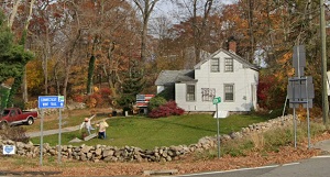
An image of Ledyard
More city maps of Connecticut:
- Map of Bridgeport
Bridgeport is a city located in the southwestern part of the state of Connecticut, in the United S... - Map of Meriden
Meriden, incorporated in 1867, is a city in New Haven County, central Connecticut. Its population ... - Map of West Hartford
West Hartford is a town in Connecticut, a large suburb of Hartford with 64 thousand residents. The... - Map of East Hartford
East Hartford, Connecticut is a superb town located in Hartford County. East Hartford is home to 5... - Map of Shelton
Shelton, Connecticut is an exceptional city situated in Fairfield County. Shelton is populated the... - Map of Glastonbury
Glastonbury, Connecticut is an impressive town located in Hartford County. The approximate populat... - Map of Cheshire
Cheshire, Connecticut is a splendid town situated in New Haven County. The approximate population ... - Map of Newtown
Newtown, Connecticut (incorporated in 1711) is a fantastic town located in Fairfield County. Newto... - Map of Mansfield
Mansfield, Connecticut is a splendid town situated 26 miles east to Hartford, in Tolland County. T... - Map of Watertown
Watertown, Connecticut is a fantastic town located in Litchfield County. Watertown is home to 22 t... - Map of New Canaan
New Canaan, Connecticut is a breathtaking town situated in Fairfield County. New Canaan was founde... - Map of Avon
Avon, Connecticut (incorporated in 1830) is a charming town found in Hartford County. The populati... - Map of Madison
Madison is a town in New Haven County, Connecticut, United States. It is located on the Long Islan... - Map of Ellington
Ellington, Connecticut is a lovely town located in Tolland County. Ellington is home to 16 thousan... - Map of East Hampton
East Hampton, Connecticut is a shining town located in Middlesex County. East Hampton is known for... - Map of Plymouth
Plymouth, Connecticut is a hilarious town situated in Litchfield County. Plymouth is known for its... - Map of Old Saybrook
Old Saybrook, Connecticut is a lovely coastal town in Middlesex County, which is located where the...
Distances from Ledyard, Connecticut:
- Distance between Ledyard and Bridgeport
- Distance between Ledyard and Meriden
- Distance between Ledyard and West Hartford
- Distance between Ledyard and East Hartford
- Distance between Ledyard and Shelton
- Distance between Ledyard and Glastonbury
- Distance between Ledyard and Cheshire
- Distance between Ledyard and Newtown
- Distance between Ledyard and Mansfield
- Distance between Ledyard and Watertown
- Distance between Ledyard and New Canaan
- Distance between Ledyard and Avon
- Distance between Ledyard and Madison
- Distance between Ledyard and Ellington
- Distance between Ledyard and East Hampton
- Distance between Ledyard and Plymouth
- Distance between Ledyard and Old Saybrook
Full list of Connecticut maps
This online map of Ledyard, Connecticut is provided by Bing Maps. Please add a bookmark and share the page with your friends!