Kent County on the map of Delaware 2026. Cities, roads, borders and directions in Kent County of Delaware.
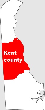
USA / Delaware / Kent CountyKent County is located in the central part of Delaware. This well known county was established in 1680. The county seat of Kent County is Dover. The population of Kent County is about 184 thousand inhabitants. The total area of the county is about 800 square miles. This map shows the borders of Kent County as well as neighboring counties, including major highways and natural objecsts as of 2026. Zoom in or out of the map using the plus/minus panel. Move the center of this map by dragging it. Also check out the satellite map of Kent County.
The borders of Kent County over the map of Delaware
Explore some more counties of Delaware:
Full list of Delaware maps
This online map of Kent County, Delaware is provided by Bing Maps. Please add a bookmark and share the page with your friends!
© 2026 City maps and famous places