The exact coordinates of Bay Harbor Islands Florida for your GPS track:
Latitude 25.887735 North, Longitude 80.13166 West.
Please share the link with friends and neighbors:
Share on Facebook
Share on WhatsApp
Share on Telegram
Share on Facebook
Share on WhatsApp
Share on Telegram
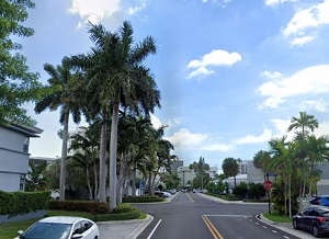
An image of Bay Harbor Islands
More city maps of Florida:
- Map of Hollywood
Hollywood, Florida is a city founded in 1921. It is located on the eastern coast of Florida, south... - Map of Miramar
Miramar is a city in southern Florida, part of the greater Miami urban area. It is located south t... - Map of Clearwater
Clearwater (incorporated 1915) is a city on the western coast of Florida (Tampa Bay Area) with 110... - Map of Naples
Naples, Florida is a small city located on the western coast of Florida, on the Naples-Marco Islan... - Map of Pompano Beach
Pompano Beach is a coastal city in southern Florida, right to the North of Fort Lauderdale. The po... - Map of Boca Raton
Boca Raton is a coastal city in Florida, located 43 miles north to Miami. The population of Boca R... - Map of Brandon
Brandon, Florida is a CDP (unincorporated city) in Tampa Bay area, located some 11 miles east to d... - Map of Alafaya
Alafaya, Florida is a CDP inside the Greater Orlando area with more than 91 thousand residents. Al... - Map of Largo
Largo, Florida is a city in Tampa Bay Area with 82 thousand residents. Largo is nicknamed as The C... - Map of Lauderhill
The City of Lauderhill, Florida is a wonderful place situated near Fort Lauderdale in Broward Coun... - Map of Poinciana
Poinciana, Florida is a beautiful CDP situated in Osceola County, only 30 miles south to Orlando. ... - Map of Port Orange
Port Orange, Florida is a positive coastal city located in Volusia County, about 52 miles northeas... - Map of Coconut Creek
Coconut Creek, Florida is a wonderful city situated near Pompano Beach in Broward County. Coconut ... - Map of Margate
Margate, Florida is a nice residential city located near Pompano Beach in Broward County. Margate ... - Map of Tamiami
Tamiami, Florida is a wonderful CDP situated in Miami-Dade County, just about 15 miles west to Mia... - Map of Pensacola
Pensacola is a wonderful coastal city situated on the northwestern edge of Florida. It is the coun... - Map of Titusville
Titusville, Florida is a remarkable coastal city and the county seat of Brevard County. Titusville...
Full list of Florida maps
This online map of Bay Harbor Islands, Florida is provided by Bing Maps. Please add a bookmark and share the page with your friends!