The exact coordinates of Cocoa Beach Florida for your GPS track:
Latitude 28.320318 North, Longitude 80.610054 West.
Please share the link with friends and neighbors:
Share on Facebook
Share on WhatsApp
Share on Telegram
Share on Facebook
Share on WhatsApp
Share on Telegram
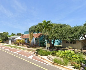
An image of Cocoa Beach
More city maps of Florida:
- Map of Tampa
Tampa is the third largest city in the state of Florida, with a population of around 390 thousand ... - Map of Cape Coral
Cape Coral is a city in Lee County, Florida, United States. It is the largest city between Tampa a... - Map of Davie
Davie, incorporated in 1963, is a large northern suburb of Miami, Florida. With more than 106 thou... - Map of Lehigh Acres
Lehigh Acres is a large CDP near Cape Coral, Florida. The population of Lehigh Acres exceeds 123 t... - Map of Melbourne
Melbourne, Florida is a beautiful coastal city in Brevard County with 85 thousand residents. It wa... - Map of Kendall
Kendall, Florida is a CDP on the southwestern outskirts of Miami metro area with 80 thousand resid... - Map of Kissimmee
Kissimmee, Florida is an excellent suburban city of Orlando, located in Osceola County. Kissimmee ... - Map of Daytona Beach
Daytona Beach, Florida is a remarkable coastal city located in Volusia County, about 57 miles nort... - Map of Port Charlotte
Port Charlotte, Florida is a nice seaside CDP situated in Charlotte County. Port Charlotte is popu... - Map of Palm Harbor
Palm Harbor, Florida is an unincorporated coastal city located in Pinellas County, about 23 miles ... - Map of Fountainebleau
Fountainebleau, Florida is a CDP situated in Miami-Dade County, about 11 miles west to downtown Mi... - Map of Palm Beach Gardens
Palm Beach Gardens, Florida is an excellent city located in Palm Beach County. Palm Beach Gardens... - Map of St. Cloud
St. Cloud, Florida is an excellent city located in Osceola County, about 27 miles south to Orlando... - Map of Ocoee
Ocoee, Florida is a prominent city, a western suburb of Orlando, situated in Orange County. The to... - Map of Oakland Park
Oakland Park, Florida is a cool city located in Broward County, between Fort Lauderdale and Pompan... - Map of Ormond Beach
Ormond Beach, Florida is a cool coastal city located in Volusia County, about 60 miles northeast t... - Map of Oviedo
Oviedo, Florida is a beautiful city situated in Seminole County, about 16 miles northeast to Orlan...
Full list of Florida maps
This online map of Cocoa Beach, Florida is provided by Bing Maps. Please add a bookmark and share the page with your friends!