The exact coordinates of Cocoa West Florida for your GPS track:
Latitude 28.364111 North, Longitude 80.771347 West.
Please share the link with friends and neighbors:
Share on Facebook
Share on WhatsApp
Share on Telegram
Share on Facebook
Share on WhatsApp
Share on Telegram
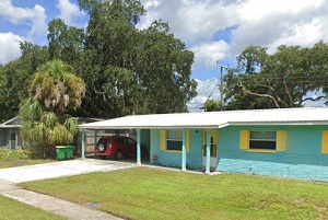
An image of Cocoa West
More city maps of Florida:
- Map of Tallahassee
Tallahassee is the Capital city of Florida with population of about 181 thousand. Tallahassee is a... - Map of Port Saint Lucie
Port St. Lucie is a city in St. Lucie County, Florida, United States. It is the eighth most populo... - Map of Jacksonville
Jacksonville, Florida is the largest city in the state and the county seat of Duval County with ov... - Map of Pembroke Pines
Pembroke Pines, Florida is a quiet northern suburb of Miami with 170 thousand inhabitants.... - Map of Gainesville
Gainesville is a city in Alachua County, northern Florida, with 128 thousand inhabitants. It was c... - Map of Coral Springs
Coral Springs is a city in southern Florida (Broward County), and a part of Miami urban area. The ... - Map of Miami Gardens
Miami Gardens, Florida is a large northern suburb of Miami with 112 thousand inhabitants. It was i... - Map of Palm Bay
Palm Bay is a city on the eastern coast of Florida with 107 thousand inhabitants. Palm Bay is the ... - Map of West Palm Beach
West Palm Beach is a coastal city in South Florida with 108+ thousand inhabitants. It was incorpor... - Map of Lakeland
Lakeland is a city in Florida, located to the east of Tampa and incorporated in 1885. The populati... - Map of Palm Coast
Palm Coast is a young city in Flagler County. northern Florida, with more than 95 thousand inhabit... - Map of Deerfield Beach
Deerfield Beach is a coastal city in Florida, located in Broward County. The population of Deerfie... - Map of Town 'n' Country
Town 'n' Country is a large CDP in Florida, located in Hillsborough County to the northeast of Tam... - Map of Boynton Beach
Boynton Beach, Florida (incorporated 1920) is a coastal city located 60 miles north to downtown Mi... - Map of Pine Hills
Pine Hills, Florida is a beautiful CDP and a suburb of Orlando situated in Orange County. The tota... - Map of North Port
North Port, Florida is a positive city located in Sarasota County, about 85 miles south to Tampa. ... - Map of Wellington
Wellington, Florida is a cool village located in Palm Beach County. The total population of Wellin...
Full list of Florida maps
This online map of Cocoa West, Florida is provided by Bing Maps. Please add a bookmark and share the page with your friends!