The exact coordinates of Daytona Beach Shores Florida for your GPS track:
Latitude 29.171919 North, Longitude 80.980278 West.
Please share the link with friends and neighbors:
Share on Facebook
Share on WhatsApp
Share on Telegram
Share on Facebook
Share on WhatsApp
Share on Telegram
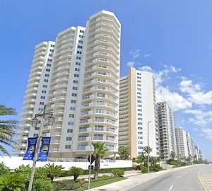
An image of Daytona Beach Shores
More city maps of Florida:
- Map of Miami
Miami is the second largest city in the state of Florida, with a population of around 460 thousand... - Map of Orlando
Orlando is one of the biggest cities in Florida with 280 thousand inhabitants.... - Map of Hialeah
Hialeah, Florida is a diverse and vibrant city, with a population of over 233 thousand people. The... - Map of Sunrise
Sunrise, Florida, incorporated in 1961 as Sunrise Golf Village, is a city located to the west of F... - Map of Deltona
Deltona, previously known as Deltona Lakes, is a city in northern Florida, in the western part of ... - Map of Spring Hill
Spring Hill, Florida is a large CDP in the northern part of Tampa Bay area. The population of Spri... - Map of Weston
Weston, Florida is a cool city located in Broward County, about 20 miles west to Fort Lauderdale. ... - Map of Tamarac
Tamarac, Florida is an excellent city located near Fort Lauderdale in Broward County. Tamarac is p... - Map of The Hammocks
The Hammocks, Florida is a CDP situated in Miami-Dade County, about 20 miles southwest to Miami. T... - Map of Wesley Chapel
Wesley Chapel, Florida is a cool CDP located in Pasco County, only 23 miles northeast to Tampa. Th... - Map of Sarasota
Sarasota, Florida is a beautiful coastal city situated in Sarasota County, about 60 miles south to... - Map of Kendale Lakes
Kendale Lakes, Florida is a cool CDP located in Miami-Dade County, about 20 miles southwest to dow... - Map of Apopka
Apopka, Florida is a cool city located in Orange County, only about 20 miles northwest to Orlando.... - Map of Horizon West
Horizon West, Florida is a beautiful CDP situated in Orange County, about 20 miles southwest to Or... - Map of North Lauderdale
North Lauderdale, Florida is a beautiful city situated in Broward County, about 13 miles northwest... - Map of North Miami Beach
North Miami Beach, Florida is a positive coastal city located in Miami-Dade County, about 17 miles... - Map of The Acreage
The Acreage, Florida is a beautiful CDP situated in Palm Beach County. The total population of The...
Full list of Florida maps
This online map of Daytona Beach Shores, Florida is provided by Bing Maps. Please add a bookmark and share the page with your friends!