The exact coordinates of Fort Meade Florida for your GPS track:
Latitude 27.752392 North, Longitude 81.802193 West.
Share on Facebook
Share on WhatsApp
Share on Telegram
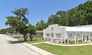
An image of Fort Meade

More city maps of Florida:
- Map of Hollywood
Hollywood, Florida is a city founded in 1921. It is located on the eastern coast of Florida, south... - Map of Miramar
Miramar is a city in southern Florida, part of the greater Miami urban area. It is located south t... - Map of Clearwater
Clearwater (incorporated 1915) is a city on the western coast of Florida (Tampa Bay Area) with 110... - Map of Naples
Naples, Florida is a small city located on the western coast of Florida, on the Naples-Marco Islan... - Map of Pompano Beach
Pompano Beach is a coastal city in southern Florida, right to the North of Fort Lauderdale. The po... - Map of Boca Raton
Boca Raton is a coastal city in Florida, located 43 miles north to Miami. The population of Boca R... - Map of Brandon
Brandon, Florida is a CDP (unincorporated city) in Tampa Bay area, located some 11 miles east to d... - Map of Alafaya
Alafaya, Florida is a CDP inside the Greater Orlando area with more than 91 thousand residents. Al... - Map of Largo
Largo, Florida is a city in Tampa Bay Area with 82 thousand residents. Largo is nicknamed as The C... - Map of Lauderhill
The City of Lauderhill, Florida is a wonderful place situated near Fort Lauderdale in Broward Coun... - Map of Poinciana
Poinciana, Florida is a beautiful CDP situated in Osceola County, only 30 miles south to Orlando. ... - Map of Port Orange
Port Orange, Florida is a positive coastal city located in Volusia County, about 52 miles northeas... - Map of Coconut Creek
Coconut Creek, Florida is a wonderful city situated near Pompano Beach in Broward County. Coconut ... - Map of Margate
Margate, Florida is a nice residential city located near Pompano Beach in Broward County. Margate ... - Map of Tamiami
Tamiami, Florida is a wonderful CDP situated in Miami-Dade County, just about 15 miles west to Mia... - Map of Pensacola
Pensacola is a wonderful coastal city situated on the northwestern edge of Florida. It is the coun... - Map of Titusville
Titusville, Florida is a remarkable coastal city and the county seat of Brevard County. Titusville...
Full list of Florida maps
This online map of Fort Meade, Florida is provided by Bing Maps. Please add a bookmark and share the page with your friends!
