The exact coordinates of Kathleen Florida for your GPS track:
Latitude 28.123034 North, Longitude 82.025543 West.
Please share the link with friends and neighbors:
Share on Facebook
Share on WhatsApp
Share on Telegram
Share on Facebook
Share on WhatsApp
Share on Telegram
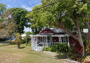
An image of Kathleen
More city maps of Florida:
- Map of Tampa
Tampa is the third largest city in the state of Florida, with a population of around 390 thousand ... - Map of Cape Coral
Cape Coral is a city in Lee County, Florida, United States. It is the largest city between Tampa a... - Map of Davie
Davie, incorporated in 1963, is a large northern suburb of Miami, Florida. With more than 106 thou... - Map of Lehigh Acres
Lehigh Acres is a large CDP near Cape Coral, Florida. The population of Lehigh Acres exceeds 123 t... - Map of Melbourne
Melbourne, Florida is a beautiful coastal city in Brevard County with 85 thousand residents. It wa... - Map of Kendall
Kendall, Florida is a CDP on the southwestern outskirts of Miami metro area with 80 thousand resid... - Map of Kissimmee
Kissimmee, Florida is an excellent suburban city of Orlando, located in Osceola County. Kissimmee ... - Map of Daytona Beach
Daytona Beach, Florida is a remarkable coastal city located in Volusia County, about 57 miles nort... - Map of Port Charlotte
Port Charlotte, Florida is a nice seaside CDP situated in Charlotte County. Port Charlotte is popu... - Map of Palm Harbor
Palm Harbor, Florida is an unincorporated coastal city located in Pinellas County, about 23 miles ... - Map of Fountainebleau
Fountainebleau, Florida is a CDP situated in Miami-Dade County, about 11 miles west to downtown Mi... - Map of Palm Beach Gardens
Palm Beach Gardens, Florida is an excellent city located in Palm Beach County. Palm Beach Gardens... - Map of St. Cloud
St. Cloud, Florida is an excellent city located in Osceola County, about 27 miles south to Orlando... - Map of Ocoee
Ocoee, Florida is a prominent city, a western suburb of Orlando, situated in Orange County. The to... - Map of Oakland Park
Oakland Park, Florida is a cool city located in Broward County, between Fort Lauderdale and Pompan... - Map of Ormond Beach
Ormond Beach, Florida is a cool coastal city located in Volusia County, about 60 miles northeast t... - Map of Oviedo
Oviedo, Florida is a beautiful city situated in Seminole County, about 16 miles northeast to Orlan...
Full list of Florida maps
This online map of Kathleen, Florida is provided by Bing Maps. Please add a bookmark and share the page with your friends!