The exact coordinates of LaBelle Florida for your GPS track:
Latitude 26.761841 North, Longitude 81.437256 West.
Please share the link with friends and neighbors:
Share on Facebook
Share on WhatsApp
Share on Telegram
Share on Facebook
Share on WhatsApp
Share on Telegram
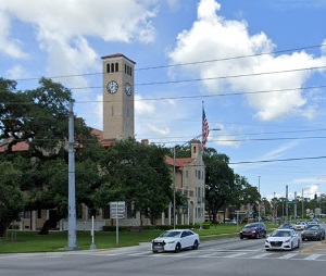
An image of LaBelle
More city maps of Florida:
- Map of Miami
Miami is the second largest city in the state of Florida, with a population of around 460 thousand... - Map of Orlando
Orlando is one of the biggest cities in Florida with 280 thousand inhabitants.... - Map of Hialeah
Hialeah, Florida is a diverse and vibrant city, with a population of over 233 thousand people. The... - Map of Sunrise
Sunrise, Florida, incorporated in 1961 as Sunrise Golf Village, is a city located to the west of F... - Map of Deltona
Deltona, previously known as Deltona Lakes, is a city in northern Florida, in the western part of ... - Map of Spring Hill
Spring Hill, Florida is a large CDP in the northern part of Tampa Bay area. The population of Spri... - Map of Weston
Weston, Florida is a cool city located in Broward County, about 20 miles west to Fort Lauderdale. ... - Map of Tamarac
Tamarac, Florida is an excellent city located near Fort Lauderdale in Broward County. Tamarac is p... - Map of The Hammocks
The Hammocks, Florida is a CDP situated in Miami-Dade County, about 20 miles southwest to Miami. T... - Map of Wesley Chapel
Wesley Chapel, Florida is a cool CDP located in Pasco County, only 23 miles northeast to Tampa. Th... - Map of Sarasota
Sarasota, Florida is a beautiful coastal city situated in Sarasota County, about 60 miles south to... - Map of Kendale Lakes
Kendale Lakes, Florida is a cool CDP located in Miami-Dade County, about 20 miles southwest to dow... - Map of Apopka
Apopka, Florida is a cool city located in Orange County, only about 20 miles northwest to Orlando.... - Map of Horizon West
Horizon West, Florida is a beautiful CDP situated in Orange County, about 20 miles southwest to Or... - Map of North Lauderdale
North Lauderdale, Florida is a beautiful city situated in Broward County, about 13 miles northwest... - Map of North Miami Beach
North Miami Beach, Florida is a positive coastal city located in Miami-Dade County, about 17 miles... - Map of The Acreage
The Acreage, Florida is a beautiful CDP situated in Palm Beach County. The total population of The...
Full list of Florida maps
This online map of LaBelle, Florida is provided by Bing Maps. Please add a bookmark and share the page with your friends!