The exact coordinates of Samsula-Spruce Creek Florida for your GPS track:
Latitude 29.043707 North, Longitude 81.067482 West.
Share on Facebook
Share on WhatsApp
Share on Telegram
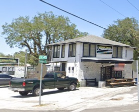
An image of Samsula-Spruce Creek

More city maps of Florida:
- Map of Tallahassee
Tallahassee is the Capital city of Florida with population of about 181 thousand. Tallahassee is a... - Map of Port Saint Lucie
Port St. Lucie is a city in St. Lucie County, Florida, United States. It is the eighth most populo... - Map of Jacksonville
Jacksonville, Florida is the largest city in the state and the county seat of Duval County with ov... - Map of Pembroke Pines
Pembroke Pines, Florida is a quiet northern suburb of Miami with 170 thousand inhabitants.... - Map of Gainesville
Gainesville is a city in Alachua County, northern Florida, with 128 thousand inhabitants. It was c... - Map of Coral Springs
Coral Springs is a city in southern Florida (Broward County), and a part of Miami urban area. The ... - Map of Miami Gardens
Miami Gardens, Florida is a large northern suburb of Miami with 112 thousand inhabitants. It was i... - Map of Palm Bay
Palm Bay is a city on the eastern coast of Florida with 107 thousand inhabitants. Palm Bay is the ... - Map of West Palm Beach
West Palm Beach is a coastal city in South Florida with 108+ thousand inhabitants. It was incorpor... - Map of Lakeland
Lakeland is a city in Florida, located to the east of Tampa and incorporated in 1885. The populati... - Map of Palm Coast
Palm Coast is a young city in Flagler County. northern Florida, with more than 95 thousand inhabit... - Map of Deerfield Beach
Deerfield Beach is a coastal city in Florida, located in Broward County. The population of Deerfie... - Map of Town 'n' Country
Town 'n' Country is a large CDP in Florida, located in Hillsborough County to the northeast of Tam... - Map of Boynton Beach
Boynton Beach, Florida (incorporated 1920) is a coastal city located 60 miles north to downtown Mi... - Map of Pine Hills
Pine Hills, Florida is a beautiful CDP and a suburb of Orlando situated in Orange County. The tota... - Map of North Port
North Port, Florida is a positive city located in Sarasota County, about 85 miles south to Tampa. ... - Map of Wellington
Wellington, Florida is a cool village located in Palm Beach County. The total population of Wellin...
Full list of Florida maps
This online map of Samsula-Spruce Creek, Florida is provided by Bing Maps. Please add a bookmark and share the page with your friends!
