The exact coordinates of Carrollton Georgia for your GPS track:
Latitude 33.580067 North, Longitude 85.074898 West.
Please share the link with friends and neighbors:
Share on Facebook
Share on WhatsApp
Share on Telegram
Share on Facebook
Share on WhatsApp
Share on Telegram
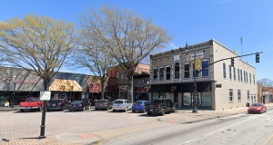
An image of Carrollton
More city maps of Georgia:
- Map of Athens
Athens-Clarke County is a consolidated city-county located in the northeastern part of the state o... - Map of Columbus
Columbus is a city in Muscogee County, Georgia, United States. It is the third most populous city ... - Map of Warner Robins
Warner Robins, founded in 1942, is a city in central Georgia with 78 thousand residents. The city ... - Map of Stonecrest
Stonecrest, Georgia is a city located on the eastern outskirts of Atlanta. The population of Stone... - Map of Peachtree Corners
Peachtree Corners, Georgia is a cool city located in Gwinnett County. The total population of Peac... - Map of East Point
East Point, Georgia is a suburban city of Atlanta situated in Fulton County. Today East Point is p... - Map of Douglasville
Douglasville, Georgia is a wonderful city and the county seat of Douglas County. Today Douglasvill... - Map of Dalton
Dalton, Georgia is an attractive city and the county seat of Whitfield County. Dalton is home to 3... - Map of McDonough
McDonough, Georgia is a charming city standing 30 miles southeast of Atlanta, in Henry County. The... - Map of Candler-McAfee
Candler-McAfee is a neighborhood located in DeKalb County, Georgia, United States. It is located i... - Map of Suwanee
Suwanee is a city located in Gwinnett County, Georgia, United States. It is located in the northea... - Map of Kingsland
Kingsland, Georgia is a shining city in Camden County, located in the southeastern part of the sta... - Map of Milledgeville
Milledgeville, Georgia is a shining city located in Baldwin County, about 90 miles southeast of At... - Map of Buford
Buford is a shining city located in northern Georgia, United States. It is part of Gwinnett County... - Map of Dublin
Dublin, Georgia is a city located in Laurens County, approximately 90 miles southeast of Atlanta. ... - Map of Grovetown
Grovetown, Georgia is a city located in Columbia County, which is part of the Augusta metropolitan... - Map of Moultrie
Moultrie is a city located in Colquitt County, in the state of Georgia. It is located in southern ...
Distances from Carrollton, Georgia:
- Distance between Carrollton and Athens
- Distance between Carrollton and Columbus
- Distance between Carrollton and Warner Robins
- Distance between Carrollton and Stonecrest
- Distance between Carrollton and Peachtree Corners
- Distance between Carrollton and East Point
- Distance between Carrollton and Douglasville
- Distance between Carrollton and Dalton
- Distance between Carrollton and McDonough
- Distance between Carrollton and Candler-McAfee
- Distance between Carrollton and Suwanee
- Distance between Carrollton and Kingsland
- Distance between Carrollton and Milledgeville
- Distance between Carrollton and Buford
- Distance between Carrollton and Dublin
- Distance between Carrollton and Grovetown
- Distance between Carrollton and Moultrie
Full list of Georgia maps
This online map of Carrollton, Georgia is provided by Bing Maps. Please add a bookmark and share the page with your friends!