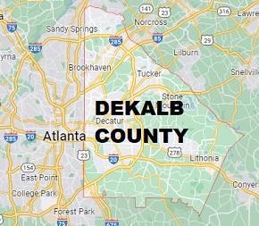
DeKalb County on the map of Georgia 2026. Cities, roads, borders and directions in DeKalb County of Georgia.
USA / Georgia / DeKalb CountyDeKalb County is one of the most populous counties in Georgia, home to at least 764 thousand people. Its county seat is Decatur, and the county includes eastern parts of Atlanta. This map shows the borders of DeKalb County as well as neighboring counties, including major highways and natural objecsts as of 2026. Zoom in or out of the map using the plus/minus panel. Move the center of this map by dragging it. Also check out the satellite map of DeKalb County.
The borders of DeKalb County over the map of Georgia
Explore some more counties of Georgia:
- Worth County
- Wilkinson County
- Wilkes County
- Wilcox County
- Whitfield County
- White County
- Wheeler County
- Webster County
- Wayne County
- Washington County
- Warren County
- Ware County
- Walton County
- Walker County
- Upson County
- Union County
- Twiggs County
- Turner County
- Troup County
- Treutlen County
Full list of Georgia maps
This online map of DeKalb County, Georgia is provided by Bing Maps. Please add a bookmark and share the page with your friends!
© 2026 City maps and famous places