Gordon County on the map of Georgia 2025. Cities, roads, borders and directions in Gordon County of Georgia.
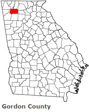
USA / Georgia / Gordon CountyGordon County is located in the northwestern part of Georgia. This hilarious county is named after William Washington Gordon (1796-1842), first president of the Central of Georgia Railroad. The county seat of Gordon County is Calhoun. The county's area is about 355 square miles. Founded in 1850, today Gordon County is home to 58 thousand residents. This map shows the borders of Gordon County as well as neighboring counties, including major highways and natural objecsts as of 2025. Zoom in or out of the map using the plus/minus panel. Move the center of this map by dragging it. Also check out the satellite map of Gordon County.
The borders of Gordon County over the map of Georgia
Explore some more counties of Georgia:
- Worth County
- Wilkinson County
- Wilkes County
- Wilcox County
- Whitfield County
- White County
- Wheeler County
- Webster County
- Wayne County
- Washington County
- Warren County
- Ware County
- Walton County
- Walker County
- Upson County
- Union County
- Twiggs County
- Turner County
- Troup County
- Treutlen County
Full list of Georgia maps
This online map of Gordon County, Georgia is provided by Bing Maps. Please add a bookmark and share the page with your friends!
© 2025 City maps and famous places