The exact coordinates of Tifton Georgia for your GPS track:
Latitude 31.4513 North, Longitude 83.509323 West.
Please share the link with friends and neighbors:
Share on Facebook
Share on WhatsApp
Share on Telegram
Share on Facebook
Share on WhatsApp
Share on Telegram
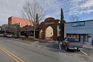
An image of Tifton
More city maps of Georgia:
- Map of Augusta
Augusta is a city located in the eastern part of the state of Georgia, in the United States. It is... - Map of Macon
Macon is a city in central Georgia. Its population exceeds 157 thousand residents.... - Map of Marietta
Marietta, Georgia is a city in Cobb County with 60 thousand residents. Marietta is located only 20... - Map of Valdosta
Valdosta is a city on the southern border of Georgia with 56 thousand inhabitants. The city was in... - Map of Brookhaven
Brookhaven, Georgia is a remarkable city located on the northern edge of Atlanta, in DeKalb County... - Map of Mableton
Mableton, Georgia is a nice CDP situated about 15 miles northwest to downtown Atlanta, in Cobb Cou... - Map of Rome
Rome, Georgia is an attractive city and the county seat of Floyd County. Incorporated on December ... - Map of Hinesville
Hinesville, Georgia is an attractive city located in Liberty County, about 42 miles southwest of S... - Map of Statesboro
Statesboro, Georgia is a charming city and the county seat of Bulloch County. The population of St... - Map of Kennesaw
Kennesaw, Georgia is a lovely city located 27 miles northwest of Atlanta, in Cobb County. Kennesaw... - Map of Union City
Union City is a city located in Fulton County, Georgia, United States. It is located in the southe... - Map of Griffin
Griffin is a city located in Spalding County, Georgia, United States. It stands approximately 40 m... - Map of Snellville
Snellville, Georgia is a hilarious city situated in Gwinnett County. It is a part of the Atlanta m... - Map of St. Marys
St. Marys, Georgia is a dynamic city in Camden County. It is located in the southeastern part of t... - Map of Powder Springs
Powder Springs is a city located in Cobb County, Georgia, United States. It has a population of ap... - Map of Richmond Hill
Richmond Hill, Georgia is a city located in Bryan County. It is a suburb of Savannah, which is app... - Map of Wilmington Island
Wilmington Island is a community located in Chatham County, on the eastern coast of Georgia, near ...
Distances from Tifton, Georgia:
- Distance between Tifton and Augusta
- Distance between Tifton and Macon
- Distance between Tifton and Marietta
- Distance between Tifton and Valdosta
- Distance between Tifton and Brookhaven
- Distance between Tifton and Mableton
- Distance between Tifton and Rome
- Distance between Tifton and Hinesville
- Distance between Tifton and Statesboro
- Distance between Tifton and Kennesaw
- Distance between Tifton and Union City
- Distance between Tifton and Griffin
- Distance between Tifton and Snellville
- Distance between Tifton and St. Marys
- Distance between Tifton and Powder Springs
- Distance between Tifton and Richmond Hill
- Distance between Tifton and Wilmington Island
Full list of Georgia maps
This online map of Tifton, Georgia is provided by Bing Maps. Please add a bookmark and share the page with your friends!