The exact coordinates of Tucker Georgia for your GPS track:
Latitude 33.855167 North, Longitude 84.210251 West.
Please share the link with friends and neighbors:
Share on Facebook
Share on WhatsApp
Share on Telegram
Share on Facebook
Share on WhatsApp
Share on Telegram
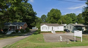
An image of Tucker
More city maps of Georgia:
- Map of Albany
Albany, Georgia, incorporated in 1838, is a small and beautiful city located in Dougherty County. ... - Map of Gainesville
Gainesville, Georgia is an excellent city and the county seat of Hall County. Gainesville, which s... - Map of Peachtree City
Peachtree City, Georgia is a nice city standing 30 miles southwest to Atlanta, in Fayette County. ... - Map of Redan
Redan, Georgia is a stylish CDP found in DeKalb County, about 16 miles east of Atlanta. The popula... - Map of LaGrange
The city of LaGrange, Georgia is the county seat of Troup County. Incorporated in December 1828, t... - Map of Chamblee
Chamblee is a city located in DeKalb County, Georgia, United States, northeast of Atlanta. Chamble... - Map of Sugar Hill
Sugar Hill is a city located in Gwinnett County, Georgia, United States. It is located in the nor... - Map of Acworth
Acworth is a city located in Cobb County, Georgia, United States. It is located in the northwest p... - Map of Plains
Plains, Georgia, is a tiny town situated near Americus in Sumter County. It is known as the birthp... - Map of Thomasville
Thomasville, Georgia is a city located in Thomas County, in the southern part of the state, near t... - Map of Winder
Winder, Georgia is a beautiful city located in Barrow County, in the northeastern part of the stat... - Map of Calhoun
Calhoun, Georgia is a lovely city located in Gordon County, about 70 miles northwest of Atlanta. T... - Map of Fairburn
Fairburn, Georgia is a lovely city located in Fulton County. It has a population of approximately ... - Map of Lithia Springs
Lithia Springs, Georgia is a lovely city located in Douglas County. It is a suburb of Atlanta, whi... - Map of Brunswick
The city of Brunswick is the county seat of Glynn County, situated on the southeastern coast of Ge... - Map of Lilburn
Lilburn, Georgia is a charming city found in Gwinnett County. It is located in the Atlanta metropo... - Map of Loganville
Loganville, Georgia is a dynamic city located in Walton County. It is part of the Atlanta metropol...
Distances from Tucker, Georgia:
- Distance between Tucker and Albany
- Distance between Tucker and Gainesville
- Distance between Tucker and Peachtree City
- Distance between Tucker and Redan
- Distance between Tucker and LaGrange
- Distance between Tucker and Chamblee
- Distance between Tucker and Sugar Hill
- Distance between Tucker and Acworth
- Distance between Tucker and Plains
- Distance between Tucker and Thomasville
- Distance between Tucker and Winder
- Distance between Tucker and Calhoun
- Distance between Tucker and Fairburn
- Distance between Tucker and Lithia Springs
- Distance between Tucker and Brunswick
- Distance between Tucker and Lilburn
- Distance between Tucker and Loganville
Full list of Georgia maps
This online map of Tucker, Georgia is provided by Bing Maps. Please add a bookmark and share the page with your friends!