The exact coordinates of Ewa Beach Hawaii for your GPS track:
Latitude 21.312609 North, Longitude 158.010025 West.
Please share the link with friends and neighbors:
Share on Facebook
Share on WhatsApp
Share on Telegram
Share on Facebook
Share on WhatsApp
Share on Telegram
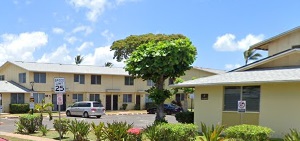
An image of Ewa Beach
More city maps of Hawaii:
- Map of Kailua
Kailua, Hawaii is a picturesque town situated in Honolulu County. It stands approximately 12 miles... - Map of Kahului
Kahului, Hawaii is a wonderful town located on the northern coast of the island of Maui. It is the... - Map of Schofield Barracks
Schofield Barracks is a United States Army installation located on the island of Oahu in the state... - Map of Maili
Maili, Hawaii is a beautiful community located on the west coast of the island of Oahu. It is most... - Map of Hickam Housing
Hickam Housing, Hawaii is a small village and a CDP adjacent to Joint Base Pearl Harbor-Hickam, a ... - Map of Lihue
Lihue, Hawaii is a CDP and the county seat of Kauai County. Today Lihue is populated by 8 thousand...
Distances from Ewa Beach, Hawaii:
- Distance between Ewa Beach and Kailua
- Distance between Ewa Beach and Kahului
- Distance between Ewa Beach and Schofield Barracks
- Distance between Ewa Beach and Maili
- Distance between Ewa Beach and Hickam Housing
- Distance between Ewa Beach and Lihue
Full list of Hawaii maps
This online map of Ewa Beach, Hawaii is provided by Bing Maps. Please add a bookmark and share the page with your friends!