The exact coordinates of Boone Iowa for your GPS track:
Latitude 42.061718 North, Longitude 93.879982 West.
Please share the link with friends and neighbors:
Share on Facebook
Share on WhatsApp
Share on Telegram
Share on Facebook
Share on WhatsApp
Share on Telegram
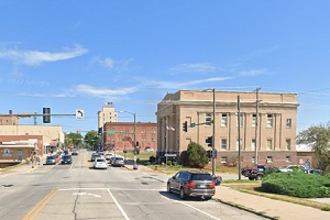
An image of Boone
More city maps of Iowa:
- Map of Des Moines
Des Moines is the capital city of the state of Iowa, located in the central part of the state. It ... - Map of Davenport
Davenport is a large city in eastern Iowa, on a bank of Mississippi. The population of Davenport h... - Map of Bettendorf
Bettendorf, Iowa is a wonderful city situated near Davenport in Scott County. Today Bettendorf is ... - Map of Fort Dodge
Fort Dodge, Iowa, is the county seat and largest city in Webster County. Fort Dodge is located on ... - Map of Coralville
Coralville, Iowa is a city located in Johnson County, Iowa, United States. It is a suburb of Iowa ... - Map of Clive
Clive, Iowa is a shining city located in Polk County. It is a suburb of Des Moines and has a popul... - Map of Pella
Pella is a wonderful city found in central Iowa, and is the county seat of Marion County. Pella is... - Map of Keokuk
Keokuk is a pleasant city located in southeastern Iowa, and is the county seat of Lee County. Keok... - Map of Bondurant
Bondurant, Iowa is a lovely city located in Polk County. It is a rapidly growing community situate... - Map of Decorah
Decorah is a city located in Winneshiek County, in the northeastern part of Iowa, near the border ... - Map of Charles City
Charles City, Iowa is the county seat of Floyd County. The city stands in northeastern Iowa along ... - Map of Adel
Adel is a city in Dallas County, in central Iowa, about 20 miles west of the city of Des Moines. A... - Map of Asbury
Asbury is a city located in Dubuque County, in eastern Iowa, near the city of Dubuque. Asbury has ... - Map of DeWitt
DeWitt is a city located in Clinton County, eastern Iowa, about 20 miles north of the city of Dave... - Map of Winterset
Winterset, Iowa is a wonderful city located in Madison County. It is the county seat of Madison Co... - Map of Manchester
Manchester, Iowa is a city that serves as the county seat of Delaware County. It is located in the...
Distances from Boone, Iowa:
- Distance between Boone and Des Moines
- Distance between Boone and Davenport
- Distance between Boone and Bettendorf
- Distance between Boone and Fort Dodge
- Distance between Boone and Coralville
- Distance between Boone and Clive
- Distance between Boone and Pella
- Distance between Boone and Keokuk
- Distance between Boone and Bondurant
- Distance between Boone and Decorah
- Distance between Boone and Charles City
- Distance between Boone and Adel
- Distance between Boone and Asbury
- Distance between Boone and DeWitt
- Distance between Boone and Winterset
- Distance between Boone and Manchester
Full list of Iowa maps
This online map of Boone, Iowa is provided by Bing Maps. Please add a bookmark and share the page with your friends!