The exact coordinates of Orange City Iowa for your GPS track:
Latitude 43.007172 North, Longitude 96.058167 West.
Please share the link with friends and neighbors:
Share on Facebook
Share on WhatsApp
Share on Telegram
Share on Facebook
Share on WhatsApp
Share on Telegram
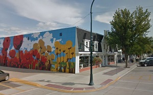
An image of Orange City
More city maps of Iowa:
- Map of Sioux City
Sioux City is a city in western Iowa, upon Missouri river. Its population is about 83 thousand inh... - Map of Ames
Ames, incorporated 1864, is a city in central Iowa with 66 thousand residents. It is located 30 mi... - Map of Urbandale
Urbandale, incorporated in 1917, is a city in central Iowa, located in the northwestern part of De... - Map of Marshalltown
The city of Marshalltown, Iowa is the county seat of Marshalll County. Founded in 1853, today Mars... - Map of Clinton
Clinton, Iowa is a shining city and the county seat of Clinton County, located along the Mississip... - Map of North Liberty
North Liberty, Iowa is a city located in Johnson County, Iowa, United States. It is a suburb of Io... - Map of Newton
Newton is a dynamic city located in central Iowa, and is the county seat of Jasper County. It has ... - Map of Oskaloosa
Oskaloosa is an adorable city in southeastern Iowa, and is the county seat of Mahaska County. Oska... - Map of Fort Madison
Fort Madison, Iowa is a lovely city and the county seat of Lee County. It has a population of appr... - Map of Sioux Center
Sioux Center is a city located in Sioux County, in the northwestern part of Iowa. The city has a d... - Map of Clear Lake
Clear Lake is a city located in Cerro Gordo County, northern Iowa, near the Minnesota border. The ... - Map of Hiawatha
Hiawatha is a city located in Linn County, Iowa. It is a suburb of Cedar Rapids, which is the seco... - Map of Oelwein
Oelwein is a city located in Fayette County, in northeastern Iowa. Historically, Oelwein has had t... - Map of Anamosa
Anamosa is a city in Jones County, eastern Iowa, located about 25 miles northeast of Cedar Rapids.... - Map of Algona
Algona is a city that serves as the county seat of Kossuth County, Iowa. Algona is located in nort... - Map of Glenwood
Glenwood is a city located in Mills County, southwestern Iowa, near the border with Nebraska. It s...
Distances from Orange City, Iowa:
- Distance between Orange City and Sioux City
- Distance between Orange City and Ames
- Distance between Orange City and Urbandale
- Distance between Orange City and Marshalltown
- Distance between Orange City and Clinton
- Distance between Orange City and North Liberty
- Distance between Orange City and Newton
- Distance between Orange City and Oskaloosa
- Distance between Orange City and Fort Madison
- Distance between Orange City and Sioux Center
- Distance between Orange City and Clear Lake
- Distance between Orange City and Hiawatha
- Distance between Orange City and Oelwein
- Distance between Orange City and Anamosa
- Distance between Orange City and Algona
- Distance between Orange City and Glenwood
Full list of Iowa maps
This online map of Orange City, Iowa is provided by Bing Maps. Please add a bookmark and share the page with your friends!