The exact coordinates of Post Falls Idaho for your GPS track:
Latitude 47.718788 North, Longitude 116.948097 West.
Please share the link with friends and neighbors:
Share on Facebook
Share on WhatsApp
Share on Telegram
Share on Facebook
Share on WhatsApp
Share on Telegram
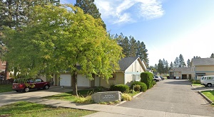
An image of Post Falls
More city maps of Idaho:
- Map of Idaho Falls
Idaho Falls is a city located in the eastern part of Idaho, United States. The city was founded in... - Map of Meridian
Meridian, incorporated in 1903, is the second largest city in Idaho and it is growing fast, counti... - Map of Caldwell
Caldwell, Idaho is a city with 60 thousand residents, the northern suburb of Nampa and county seat... - Map of Moscow
Moscow, Idaho is an adorable city and the county seat of Latah County. Moscow calling is home to 2... - Map of Ammon
Ammon is a city in Bonneville County, Idaho, United States. It is located in the eastern part of t... - Map of Blackfoot
Blackfoot is a city located in Bingham County, Idaho. It is situated in the southeastern part of t... - Map of Rathdrum
Rathdrum is a city located in northern Idaho. It is situated in Kootenai County and is part of the... - Map of Fruitland
Fruitland is a city located in southwestern Idaho, in Payette County, near the Oregon-Idaho border... - Map of Shelley
Shelley is a lovely city located in eastern Idaho. It is situated in Bingham County and is part of...
Distances from Post Falls, Idaho:
- Distance between Post Falls and Idaho Falls
- Distance between Post Falls and Meridian
- Distance between Post Falls and Caldwell
- Distance between Post Falls and Moscow
- Distance between Post Falls and Ammon
- Distance between Post Falls and Blackfoot
- Distance between Post Falls and Rathdrum
- Distance between Post Falls and Fruitland
- Distance between Post Falls and Shelley
Full list of Idaho maps
This online map of Post Falls, Idaho is provided by Bing Maps. Please add a bookmark and share the page with your friends!