The exact coordinates of East Alton Illinois for your GPS track:
Latitude 38.880836 North, Longitude 90.112259 West.
Please share the link with friends and neighbors:
Share on Facebook
Share on WhatsApp
Share on Telegram
Share on Facebook
Share on WhatsApp
Share on Telegram
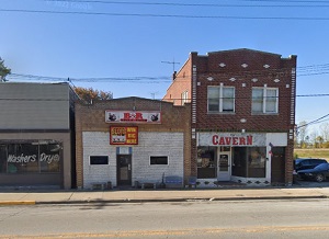
An image of East Alton
More city maps of Illinois:
- Map of Chicago
Chicago, Illinois is the third largest city in the United States and the county seat of Cook Count... - Map of Peoria
Peoria, Illinois is a city with 115 thousand inhabitants, located in the center of the state. It i... - Map of Highland Park
Highland Park is a suburban city located on the northern outskirts of Chicago, along Lake Michigan... - Map of Orland Park
Orland Park, Illinois is a nice village situated 25 miles southwest to downtown Chicago. Orland Pa... - Map of Normal
Normal, Illinois is an excellent town located near Bloomington, in McLean County. The total popula... - Map of Elmhurst
Elmhurst, Illinois is a breathtaking suburban city situated 18 miles west to downtown Chicago. Elm... - Map of Bartlett
Bartlett, Illinois is a superb village located in about 35 miles northwest to Chicago. Bartlett is... - Map of Quincy
Quincy, Illinois is a "Gem city" and the county seat of Adams County, standing on the East bank of... - Map of Carpentersville
Carpentersville, Illinois is a lovely village found in Kane County, about 40 miles northwest to do... - Map of Calumet City
Calumet City, Illinois is a lovely city situated 23 miles south to downtown Chicago, in Cook Count... - Map of O'Fallon
O'Fallon, Illinois is a fantastic city located in St. Clair County, about 18 miles east to St. Lou... - Map of Niles
Niles, Illinois is a breathtaking village situated 15 miles northwest to downtown Chicago, in Cook... - Map of Burbank
Burbank, Illinois is a breathtaking city situated in Cook County, about 14 miles southwest to down... - Map of Granite City
Granite City, Illinois is a wonderful suburban city of St. Louis, Missouri, situated in Madison Co... - Map of Oak Forest
Oak Forest, Illinois is a beautiful city located in Cook County, about 25 miles south of downtown ... - Map of Alton
Alton, Illinois is a cool city situated in Madison County, about 23 miles north of St. Louis, Miss... - Map of Homer Glen
Homer Glen, Illinois is an attractive village located in Will County, 32 miles southwest of Chicag...
Full list of Illinois maps
This online map of East Alton, Illinois is provided by Bing Maps. Please add a bookmark and share the page with your friends!