The exact coordinates of Edwardsville Illinois for your GPS track:
Latitude 38.799999 North, Longitude 89.949997 West.
Please share the link with friends and neighbors:
Share on Facebook
Share on WhatsApp
Share on Telegram
Share on Facebook
Share on WhatsApp
Share on Telegram
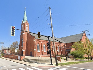
An image of Edwardsville
More city maps of Illinois:
- Map of Rockford
Rockford is a city on the northern edge of Illinois, standing on the banks of Rock River. Its popu... - Map of Cicero
Cicero, Illinois is a large western suburb of Chicago with 80 thousand residents. The town was inc... - Map of Skokie
Skokie, Illinois is an amazing village located in Cook County, about 13 miles north to Chicago. Sk... - Map of Berwyn
Berwyn, Illinois is a suburban city of Chicago situated in Cook County, only 10 miles west to the ... - Map of Wheaton
Wheaton, Illinois is a cool city located 25 miles west to downtown Chicago, in DuPage County. Whea... - Map of Downers Grove
Downers Grove, Illinois is a superb village located about 20 miles west to Chicago, in DuPage Coun... - Map of Buffalo Grove
The Village of Buffalo Grove, Illinois is situated about 35 miles northwest to downtown Chicago. B... - Map of Romeoville
Romeoville, Illinois is an impressive village located in Will County. The approximate population ... - Map of Urbana
The city of Urbana, Illinois is the county seat of Champaign County. Today Urbana is home to 39 th... - Map of Rock Island
Rock Island, Illinois is a superb city functioning as the county seat of Rock Island County. Rock ... - Map of Woodridge
Woodridge, Illinois is a breathtaking village situated near Naperville, in DuPage County. Woodridg... - Map of Mundelein
Mundelein, Illinois is a beautiful village located 40 miles northwest to Chicago, in Lake County. ... - Map of Algonquin
Algonquin, Illinois is a beautiful village located about 46 miles northwest to Chicago, in McHenry... - Map of Glen Ellyn
Glen Ellyn, Illinois is a nice village situated in DuPage County, about 24 miles west to downtown ... - Map of McHenry
McHenry, Illinois (founded in 1836) is a charming city standing 53 miles northwest of downtown Chi... - Map of Lockport
Lockport, Illinois is a wonderful city situated in Will County. Founded in 1853, today Lockport is... - Map of Collinsville
Collinsville, Illinois is a cool city situated about 14 miles east of St. Louis, Missouuri. Today ...
Distances from Edwardsville, Illinois:
- Distance between Edwardsville and Rockford
- Distance between Edwardsville and Cicero
- Distance between Edwardsville and Skokie
- Distance between Edwardsville and Berwyn
- Distance between Edwardsville and Wheaton
- Distance between Edwardsville and Downers Grove
- Distance between Edwardsville and Buffalo Grove
- Distance between Edwardsville and Romeoville
- Distance between Edwardsville and Urbana
- Distance between Edwardsville and Rock Island
- Distance between Edwardsville and Woodridge
- Distance between Edwardsville and Mundelein
- Distance between Edwardsville and Algonquin
- Distance between Edwardsville and Glen Ellyn
- Distance between Edwardsville and McHenry
- Distance between Edwardsville and Lockport
- Distance between Edwardsville and Collinsville
Full list of Illinois maps
This online map of Edwardsville, Illinois is provided by Bing Maps. Please add a bookmark and share the page with your friends!