The exact coordinates of Rochelle Illinois for your GPS track:
Latitude 41.923843 North, Longitude 89.066383 West.
Please share the link with friends and neighbors:
Share on Facebook
Share on WhatsApp
Share on Telegram
Share on Facebook
Share on WhatsApp
Share on Telegram
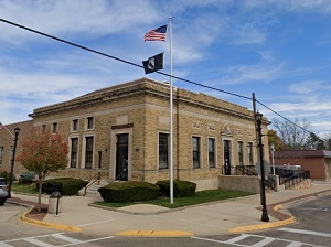
An image of Rochelle
More city maps of Illinois:
- Map of Naperville
Naperville, Illinois is a large and wealthy western suburb of Chicago with 144 thousand inhabitant... - Map of Champaign
Champaign is a city in central Illinois populated by 89 thousand residents. It was founded as West... - Map of Arlington Heights
Arlington Heights is a large suburb of Chicago located about 25 miles north to the city center. Th... - Map of Schaumburg
Schaumburg, Illinois is a large suburb of Chicago with more than 78 thousand residents. It was inc... - Map of Palatine
Palatine, Illinois is a wonderful village situated 30 miles northwest to Chicago, in Cook County. ... - Map of Mount Prospect
Mount Prospect, Illinois is a remarkable suburban village, located about 23 miles northwest to Chi... - Map of Hoffman Estates
Hoffman Estates, Illinois is a nice village situated about 35 miles northwest to downtown Chicago.... - Map of Glenview
Glenview, Illinois is a splendid village situated about 20 miles north to Chicago, in Cook County.... - Map of Moline
Moline, Illinois is a fantastic city located in Rock Island County, about 165 miles west to Chicag... - Map of Crystal Lake
Crystal Lake, Illinois is a breathtaking city situated in McHenry County, about 48 miles northwest... - Map of Streamwood
Streamwood, Illinois is an outstanding village located in Cook County, about 35 miles northwest to... - Map of Addison
Addison, Illinois is a cool suburban village situated about 21 miles west to downtown Chicago. The... - Map of St. Charles
St. Charles, Illinois is a nice city located about 43 miles west to Chicago. The approximate popul... - Map of Pekin
Pekin, Illinois is a lovely city and county seat of Tazewell County. Pekin is home to 31 thousand ... - Map of Galesburg
Galesburg, Illinois is a lovely city situated about 200 miles southwest to Chicago, in Knox County... - Map of Lansing
Lansing, Illinois is a fantastic village located in Cook County. Lansing is home to 28 thousand re... - Map of Huntley
Huntley, Illinois is a nice village located 50 miles northwest of downtown Chicago. Incorporated i...
Full list of Illinois maps
This online map of Rochelle, Illinois is provided by Bing Maps. Please add a bookmark and share the page with your friends!