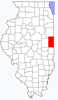
Vermilion County on the map of Illinois 2025. Cities, roads, borders and directions in Vermilion County of Illinois.
USA / Illinois / Vermilion CountyVermilion County is situated on the eastern border of Illinois. This wonderful county was named after The Vermilion River. The area of Vermilion County is about 898 square miles. This county, created in 1826, is populated today by 73 thousand residents. Danville is the county seat of Vermilion County. This map shows the borders of Vermilion County as well as neighboring counties, including major highways and natural objecsts as of 2025. Zoom in or out of the map using the plus/minus panel. Move the center of this map by dragging it. Also check out the satellite map of Vermilion County.
The borders of Vermilion County over the map of Illinois
Explore some more counties of Illinois:
- Woodford County
- Winnebago County
- Williamson County
- Will County
- Whiteside County
- White County
- Wayne County
- Washington County
- Warren County
- Wabash County
- Union County
- Tazewell County
- Stephenson County
- Stark County
- St. Clair County
- Shelby County
- Scott County
- Schuyler County
- Sangamon County
- Saline County
Full list of Illinois maps
This online map of Vermilion County, Illinois is provided by Bing Maps. Please add a bookmark and share the page with your friends!
© 2025 City maps and famous places