Fountain County on the map of Indiana 2025. Cities, roads, borders and directions in Fountain County of Indiana.
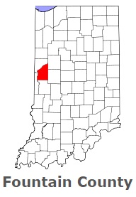
USA / Indiana / Fountain CountyFountain County is found on the western border of Indiana. This amazing county is named after Major James Fontaine, a hero of the American Revolutionary War. The population of Fountain County exceeds 16 thousand people. The county, organized on Dec 20, 1825, spans an area of 396 square miles. The county seat of Fountain County is Covington. This map shows the borders of Fountain County as well as neighboring counties, including major highways and natural objecsts as of 2025. Zoom in or out of the map using the plus/minus panel. Move the center of this map by dragging it. Also check out the satellite map of Fountain County.
The borders of Fountain County over the map of Indiana
Explore some more counties of Indiana:
- Whitley County
- White County
- Wells County
- Wayne County
- Washington County
- Warrick County
- Warren County
- Wabash County
- Vigo County
- Vermillion County
- Vanderburgh County
- Union County
- Tipton County
- Tippecanoe County
- Switzerland County
- Sullivan County
- Steuben County
- Starke County
- Spencer County
- Shelby County
Full list of Indiana maps
This online map of Fountain County, Indiana is provided by Bing Maps. Please add a bookmark and share the page with your friends!
© 2025 City maps and famous places