The exact coordinates of Huntertown Indiana for your GPS track:
Latitude 41.228092 North, Longitude 85.170494 West.
Please share the link with friends and neighbors:
Share on Facebook
Share on WhatsApp
Share on Telegram
Share on Facebook
Share on WhatsApp
Share on Telegram
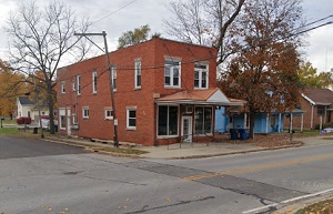
An image of Huntertown
More city maps of Indiana:
- Map of Fort Wayne
Fort Wayne is a city located in northeastern Indiana. It is the county seat of Allen County and is... - Map of Carmel
The city of Carmel is located in central Indiana. It took its name from the famous Mount Carmel in... - Map of Lafayette
Lafayette, Indiana (incorporated 1853) is a city located in Tippecanoe County, some 60 miles away ... - Map of Noblesville
Noblesville, Indiana is a large northern suburb of Indianapolis, incorporated as a city in 1887. T... - Map of Kokomo
Kokomo, Indiana is the county seat of Howard County. The approximate population of Kokomo exceeds ... - Map of Westfield
Westfield, Indiana is a fantastic city located 20 miles north to Indianapolis, in Hamilton County.... - Map of Portage
Portage, Indiana is a breathtaking city situated near Chicago, in Porter County. Portage is popula... - Map of Crown Point
Crown Point, Indiana (founded 1834) is a stylish city and the county seat of Lake County. The popu... - Map of Brownsburg
Brownsburg, Indiana is an adorable town located 17 miles northwest of Indianapolis, in Hendricks C... - Map of Schererville
Schererville is a town in St. John Township, Lake County, Indiana, United States. It is located in... - Map of Greenfield
Greenfield, Indiana is the county seat of Hancock County. Greenfield is known for its historic dow... - Map of Seymour
Seymour is a city located about 50 miles south of Indianapolis and about 35 miles north of Louisvi... - Map of Logansport
Logansport is a city located in the north-central part of Indiana, in Cass County. The city has a ... - Map of Dyer
Dyer is a town located in the northwest corner of Indiana, in Lake County. The town has a populati... - Map of New Haven
New Haven is a city located in the northeastern part of Indiana, in Allen County. The city has a p... - Map of Cedar Lake
Cedar Lake, Indiana is a town located in Lake County. It has a population of around 14 thousand pe... - Map of Madison
Madison is a city located in the state of Indiana. It is the county seat of Jefferson County and i...
Full list of Indiana maps
This online map of Huntertown, Indiana is provided by Bing Maps. Please add a bookmark and share the page with your friends!