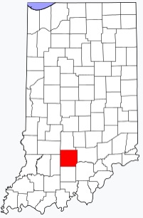
The borders of Lawrence County over the map of Indiana
Explore some more counties of Indiana:
- Whitley County
- White County
- Wells County
- Wayne County
- Washington County
- Warrick County
- Warren County
- Wabash County
- Vigo County
- Vermillion County
- Vanderburgh County
- Union County
- Tipton County
- Tippecanoe County
- Switzerland County
- Sullivan County
- Steuben County
- Starke County
- Spencer County
- Shelby County
Full list of Indiana maps
This online map of Lawrence County, Indiana is provided by Bing Maps. Please add a bookmark and share the page with your friends!