The exact coordinates of Lebanon Indiana for your GPS track:
Latitude 40.048454 North, Longitude 86.469162 West.
Please share the link with friends and neighbors:
Share on Facebook
Share on WhatsApp
Share on Telegram
Share on Facebook
Share on WhatsApp
Share on Telegram
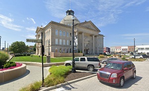
An image of Lebanon
More city maps of Indiana:
- Map of Fishers
Fishers, Indiana is a fast growing north-eastern suburb of Indianapolis with a population of almos... - Map of Anderson
Anderson, Indiana is the county seat of Madison County. The city stands about 40 miles northeast t... - Map of Jeffersonville
Jeffersonville, Indiana is the county seat of Clark County. Jeffersonville is populated these days... - Map of Merrillville
Merrillville, Indiana is a stylish town found in Lake County. The population of Merrillville excee... - Map of Michigan City
Michigan City, Indiana is an attractive lakeside city located in LaPorte County. Founded in 1830, ... - Map of Marion
Marion is the county seat and largest city of Grant County. Marion is known for its rich history ... - Map of Avon
Avon is a town located in Hendricks County, Indiana, United States. It is a suburb of Indianapolis... - Map of Shelbyville
Shelbyville is a city located in Shelby County, Indiana, about 30 miles southeast of Indianapolis.... - Map of Jasper
Jasper is a city located in the southwestern part of Indiana, in Dubois County. The city has a pop... - Map of Beech Grove
Beech Grove is a city located in Marion County, Indiana. It is a suburb of Indianapolis and has a ... - Map of Connersville
Connersville, Indiana is a city located in Fayette County. It has a population of around 14 thousa... - Map of Martinsville
Martinsville, Indiana is a city located in Morgan County, approximately 30 miles southwest of Ind... - Map of Bluffton
Bluffton, Indiana is the county seat of Wells County. It is located approximately 20 miles southwe... - Map of McCordsville
McCordsville is a town located in Vernon Township, Hancock County, Indiana. It's part of the India... - Map of Greencastle
Greencastle is the county seat of Putnam County, Indiana. The city stands in west-central Indiana,... - Map of Charlestown
Charlestown is a city located in Clark County, along the Ohio River, in the southern part of India... - Map of Tell City
Tell City is a city in Troy Township, Perry County, in the southwestern part of Indiana. It is sit...
Distances from Lebanon, Indiana:
- Distance between Lebanon and Fishers
- Distance between Lebanon and Anderson
- Distance between Lebanon and Jeffersonville
- Distance between Lebanon and Merrillville
- Distance between Lebanon and Michigan City
- Distance between Lebanon and Marion
- Distance between Lebanon and Avon
- Distance between Lebanon and Shelbyville
- Distance between Lebanon and Jasper
- Distance between Lebanon and Beech Grove
- Distance between Lebanon and Connersville
- Distance between Lebanon and Martinsville
- Distance between Lebanon and Bluffton
- Distance between Lebanon and McCordsville
- Distance between Lebanon and Greencastle
- Distance between Lebanon and Charlestown
- Distance between Lebanon and Tell City
Full list of Indiana maps
This online map of Lebanon, Indiana is provided by Bing Maps. Please add a bookmark and share the page with your friends!