The exact coordinates of Mooresville Indiana for your GPS track:
Latitude 39.612797 North, Longitude 86.374825 West.
Please share the link with friends and neighbors:
Share on Facebook
Share on WhatsApp
Share on Telegram
Share on Facebook
Share on WhatsApp
Share on Telegram
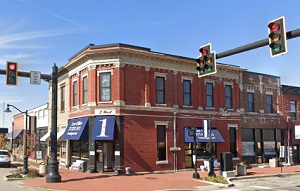
An image of Mooresville
More city maps of Indiana:
- Map of Evansville
Evansville is the third largest city in Indiana. It is located on the south-western edge of the st... - Map of Hammond
Hammond is a city in north-western Indiana, adjacent to Chicago metropolitan area. The population ... - Map of Elkhart
Elkhart, Indiana is a nice city located near South Bend, in Elkhart County. The approximate popula... - Map of Lawrence
Lawrence, Indiana is a lovely city situated about 10 miles northeast to Indianapolis, in Marion Co... - Map of Richmond
Richmond, Indiana is a wonderful city situated 72 miles east of Indianapolis, in Wayne County. Tod... - Map of Zionsville
Zionsville, Indiana is a charming town located 17 miles northwest of Indianapolis, in Boone County... - Map of East Chicago
East Chicago is a city in Lake County, Indiana, United States. It is located in the Chicago metrop... - Map of La Porte
La Porte is a city in La Porte County, Indiana, United States. It is located about 50 miles west o... - Map of Highland
Highland, Indiana is a shining town located in Lake County. Incorporated on April 4, 1910, today H... - Map of Huntington
Huntington is a lovely city located in the northeastern part of Indiana, in Huntington County. The... - Map of Griffith
Griffith is a town located in the northwest corner of Indiana, in Lake County. The town has a popu... - Map of Chesterton
Chesterton is a town located in the northwest corner of Indiana, in Porter County. It is part of t... - Map of Lake Station
Lake Station, Indiana is a city located in Lake County. It has a population of around 13 thousand ... - Map of Greensburg
The city of Greensburg, Indiana is the county seat of Decatur County. It is located approximately ... - Map of Danville
Danville, Indiana is an adorable town located in Hendricks County. Danville is the county seat of ... - Map of Kendallville
Kendallville, Indiana is a beautiful city located in Wayne Township, Noble County, approximately 4... - Map of Princeton
Princeton is the county seat of Gibson County in the southwestern part of Indiana. The city is sit...
Full list of Indiana maps
This online map of Mooresville, Indiana is provided by Bing Maps. Please add a bookmark and share the page with your friends!