The exact coordinates of Terre Haute Indiana for your GPS track:
Latitude 39.466484 North, Longitude 87.412567 West.
Please share the link with friends and neighbors:
Share on Facebook
Share on WhatsApp
Share on Telegram
Share on Facebook
Share on WhatsApp
Share on Telegram
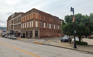
An image of Terre Haute
More city maps of Indiana:
- Map of Bloomington
Bloomington is a city in southern Indiana with a population of some 80 thousand people. Bloomingto... - Map of Indianapolis
Indianapolis is the capital and largest city of the state of Indiana.... - Map of Muncie
Muncie, Indiana is a city in Delaware County with 65 thousand residents. Incorporated in 1865 as a... - Map of Columbus
Columbus, Indiana is the county seat of Bartholomew County. The approximate population of Columbus... - Map of New Albany
New Albany, Indiana is a nice suburban city of Louisville, KY, located in Floyd County. New Alban... - Map of Valparaiso
The city of Valparaiso, Indiana is the county seat of Porter County. Incorporated on July 8, 1836,... - Map of Hobart
Hobart is a city in Lake County, Indiana, United States. It is located in the Chicago metropolitan... - Map of Munster
Munster is a town in North Township, Lake County, Indiana, United States. It is located in the Chi... - Map of St. John
St. John is a town located in Lake County, Indiana, United States. It is a suburb of Chicago and i... - Map of New Castle
New Castle is a city located in the east-central part of Indiana, in Henry County. The city has a ... - Map of Crawfordsville
Crawfordsville is a city located in Montgomery County, in the west-central part of Indiana. The ci... - Map of Warsaw
Warsaw is a city located in the northern part of Indiana, in Kosciusko County. The city has a popu... - Map of Speedway
Speedway, Indiana is a town located in Marion County, just northwest of Indianapolis. Speedway is ... - Map of Washington
Washington is a city located in the southwestern part of the state of Indiana. It is the county se... - Map of Lowell
Lowell, Indiana is a town located in Lake County, approximately 45 miles southeast of Chicago, Ill... - Map of Bargersville
Bargersville is a town located in White River Township, Johnson County, Indiana. It stands in cent... - Map of Decatur
Decatur is the county seat of Adams County, Indiana. It is situated in the northeastern part of In...
Distances from Terre Haute, Indiana:
- Distance between Terre Haute and Bloomington
- Distance between Terre Haute and Indianapolis
- Distance between Terre Haute and Muncie
- Distance between Terre Haute and Columbus
- Distance between Terre Haute and New Albany
- Distance between Terre Haute and Valparaiso
- Distance between Terre Haute and Hobart
- Distance between Terre Haute and Munster
- Distance between Terre Haute and St. John
- Distance between Terre Haute and New Castle
- Distance between Terre Haute and Crawfordsville
- Distance between Terre Haute and Warsaw
- Distance between Terre Haute and Speedway
- Distance between Terre Haute and Washington
- Distance between Terre Haute and Lowell
- Distance between Terre Haute and Bargersville
- Distance between Terre Haute and Decatur
Full list of Indiana maps
This online map of Terre Haute, Indiana is provided by Bing Maps. Please add a bookmark and share the page with your friends!