Dickinson County on the map of Kansas 2026. Cities, roads, borders and directions in Dickinson County of Kansas.
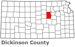
USA / Kansas / Dickinson CountyDickinson County is situated in the central part of Kansas. This beautiful county is named after Daniel Stevens Dickinson, U.S. Senator from New York and Kansas statehood advocate. The total area of Dickinson County is about 848 square miles. This county, created in 1857, is populated today by at least 18 thousand residents. Abilene is the county seat of Dickinson County. This map shows the borders of Dickinson County as well as neighboring counties, including major highways and natural objecsts as of 2026. Zoom in or out of the map using the plus/minus panel. Move the center of this map by dragging it. Also check out the satellite map of Dickinson County.
The borders of Dickinson County over the map of Kansas
Explore some more counties of Kansas:
- Wyandotte County
- Woodson County
- Wilson County
- Wichita County
- Washington County
- Wallace County
- Wabaunsee County
- Trego County
- Thomas County
- Sumner County
- Stevens County
- Stanton County
- Stafford County
- Smith County
- Sherman County
- Sheridan County
- Shawnee County
- Seward County
- Sedgwick County
- Scott County
Full list of Kansas maps
This online map of Dickinson County, Kansas is provided by Bing Maps. Please add a bookmark and share the page with your friends!
© 2026 City maps and famous places