The exact coordinates of Emporia Kansas for your GPS track:
Latitude 38.407387 North, Longitude 96.18026 West.
Please share the link with friends and neighbors:
Share on Facebook
Share on WhatsApp
Share on Telegram
Share on Facebook
Share on WhatsApp
Share on Telegram
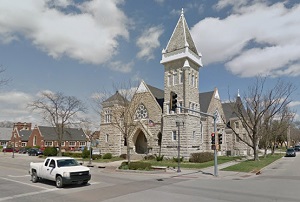
An image of Emporia
More city maps of Kansas:
- Map of Kansas City
Kansas City is a city located in the northeastern part of the state of Kansas, in the United State... - Map of Overland Park
Overland Park is the second-largest city in Kansas, with population of around 173 thousand people.... - Map of Manhattan
The city of Manhattan, Kansas (incorporated in 1857) is a county seat of Riley County. The populat... - Map of Lenexa
Lenexa, Kansas, incorporated 1907, is a city located inside Kansas City metropolitan area, near Ov... - Map of Leavenworth
Leavenworth, Kansas is the county seat of Leavenworth County. The population of Leavenworth exceed... - Map of Pittsburg
Pittsburg, Kansas is a lovely city in Crawford County, located in the southeast part of the state.... - Map of Newton
Newton is a city located in Harvey County, Kansas. It stands in the central part of the state, app... - Map of Ottawa
Ottawa, Kansas is a shining city located in Franklin County, approximately 50 miles southwest of K... - Map of Haysville
Haysville, Kansas is a city situated in Sedgwick County. It stands in south-central Kansas, appro... - Map of Augusta
Augusta, Kansas is a wonderful city situated in Butler County. It stands in south-central Kansas, ... - Map of Independence
Independence is a pleasant city found in Montgomery County, in southeastern Kansas, 115 miles nort... - Map of Basehor
Basehor, Kansas is a charming city located in Leavenworth County. It stands in northeast Kansas, a... - Map of De Soto
De Soto, Kansas is a lovely city located in Johnson County. It stands in the northeastern part of ... - Map of Paola
Paola, Kansas is a beautiful city situated in eastern Kansas, and it is part of the Kansas City me... - Map of Louisburg
Louisburg, Kansas is a shining city in Miami County. It is located in the eastern part of Kansas a...
Distances from Emporia, Kansas:
- Distance between Emporia and Kansas City
- Distance between Emporia and Overland Park
- Distance between Emporia and Manhattan
- Distance between Emporia and Lenexa
- Distance between Emporia and Leavenworth
- Distance between Emporia and Pittsburg
- Distance between Emporia and Newton
- Distance between Emporia and Ottawa
- Distance between Emporia and Haysville
- Distance between Emporia and Augusta
- Distance between Emporia and Independence
- Distance between Emporia and Basehor
- Distance between Emporia and De Soto
- Distance between Emporia and Paola
- Distance between Emporia and Louisburg
Full list of Kansas maps
This online map of Emporia, Kansas is provided by Bing Maps. Please add a bookmark and share the page with your friends!