Kearny County on the map of Kansas 2026. Cities, roads, borders and directions in Kearny County of Kansas.
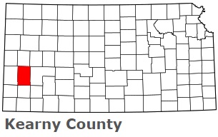
USA / Kansas / Kearny CountyKearny County is found in the western part of Kansas. This amazing county is named after Philip Kearny, American general in the Mexican–American and Civil Wars. The population of Kearny County reaches 4 thousand people. The county, organized in 1887, covers an area of 870 square miles. The county seat of Kearny County is Lakin. This map shows the borders of Kearny County as well as neighboring counties, including major highways and natural objecsts as of 2026. Zoom in or out of the map using the plus/minus panel. Move the center of this map by dragging it. Also check out the satellite map of Kearny County.
The borders of Kearny County over the map of Kansas
Explore some more counties of Kansas:
- Wyandotte County
- Woodson County
- Wilson County
- Wichita County
- Washington County
- Wallace County
- Wabaunsee County
- Trego County
- Thomas County
- Sumner County
- Stevens County
- Stanton County
- Stafford County
- Smith County
- Sherman County
- Sheridan County
- Shawnee County
- Seward County
- Sedgwick County
- Scott County
Full list of Kansas maps
This online map of Kearny County, Kansas is provided by Bing Maps. Please add a bookmark and share the page with your friends!
© 2026 City maps and famous places