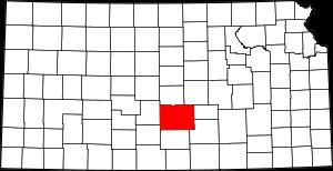
The borders of Reno County over the map of Kansas
Explore some more counties of Kansas:
- Wyandotte County
- Woodson County
- Wilson County
- Wichita County
- Washington County
- Wallace County
- Wabaunsee County
- Trego County
- Thomas County
- Sumner County
- Stevens County
- Stanton County
- Stafford County
- Smith County
- Sherman County
- Sheridan County
- Shawnee County
- Seward County
- Sedgwick County
- Scott County
Full list of Kansas maps
This online map of Reno County, Kansas is provided by Bing Maps. Please add a bookmark and share the page with your friends!