The exact coordinates of Central City Kentucky for your GPS track:
Latitude 37.293701 North, Longitude 87.123734 West.
Please share the link with friends and neighbors:
Share on Facebook
Share on WhatsApp
Share on Telegram
Share on Facebook
Share on WhatsApp
Share on Telegram
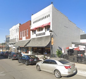
An image of Central City
More city maps of Kentucky:
- Map of Owensboro
Owensboro is the fourth largest city in Kentucky, standing on the southern bank of Ohio river, wit... - Map of Elizabethtown
Elizabethtown, Kentucky is a wonderful city and the county seat of Hardin County, about 44 miles s... - Map of Frankfort
Frankfort, Kentucky is the capital city of Kentucky and the county seat of Franklin County. Frankf... - Map of Erlanger
Erlanger, Kentucky is a wonderful city situated in Kenton County. Erlanger is home to 20 thousand ... - Map of St. Matthews
St. Matthews, Kentucky is a remarkable city and an eastern suburb of Louisville located in Jeffers... - Map of Shively
Shively, Kentucky is a lovely city located in Jefferson County. It is considered a suburb of Louis... - Map of Bardstown
Bardstown, Kentucky is a shining city situated in Nelson County. It stands in the central part of ... - Map of Lyndon
Lyndon is a city located in Jefferson County, Kentucky. It is a suburb of Louisville and is situat... - Map of La Grange
La Grange, Kentucky is a lovely city in Oldham County. It is situated approximately 22 miles north... - Map of Harrodsburg
Harrodsburg is a historic city located in Mercer County, Kentucky. It is notable for being the old... - Map of Maysville
Maysville, Kentucky is a lovely city located in Mason County. It stands along the Ohio River in no... - Map of Union
Union, Kentucky is a charming city found in Boone County. It stands in the Bluegrass Region of Ken... - Map of Russellville
Russellville is the county seat of Logan County, Kentucky. The city is situated in southwestern Ke... - Map of Hebron
Hebron, Kentucky is a lovely city located in Boone County. It is situated near the Cincinnati/Nor... - Map of Cold Spring
Cold Spring, Kentucky is a beautiful city situated in Campbell County. It is part of the greater C... - Map of Buckner
Buckner, Kentucky is a CDP located in Oldham County. It is a part of the Louisville metropolitan a...
Full list of Kentucky maps
This online map of Central City, Kentucky is provided by Bing Maps. Please add a bookmark and share the page with your friends!