The exact coordinates of Fort Wright Kentucky for your GPS track:
Latitude 39.054428 North, Longitude 84.536011 West.
Please share the link with friends and neighbors:
Share on Facebook
Share on WhatsApp
Share on Telegram
Share on Facebook
Share on WhatsApp
Share on Telegram
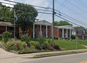
An image of Fort Wright
More city maps of Kentucky:
- Map of Florence
Florence, Kentucky is an excellent city located in Boone County, about 13 miles southwest to Cinci... - Map of Jeffersontown
Jeffersontown, Kentucky is a prominent suburban city situated in Jefferson County, about 14 miles ... - Map of Ashland
Ashland, Kentucky is an excellent city located in Boyd County, on the southern bank of Ohio River.... - Map of Burlington
Burlington, Kentucky is a CDP serving as the county seat of Boone County. The total population of ... - Map of Danville
Danville is a charming city in Boyle County, central Kentucky, with a rich history, small-town atm... - Map of Shepherdsville
Shepherdsville, Kentucky is a pleasant city found in Bullitt County. It stands in the central part... - Map of Campbellsville
Campbellsville, Kentucky is a charming city located in Taylor County. It stands in the central par... - Map of Francisville
Francisville, Kentucky is a dynamic CDP situated in Boone County, on the southern bank of Ohio Riv... - Map of Middletown
Middletown, Kentucky is a wonderful city situated in Jefferson County. It is part of the Louisvill... - Map of Hillview
Hillview is a wonderful city situated in Bullitt County, which is in the central part of Kentucky.... - Map of Corbin
Corbin is a lovely city located in Laurel County, in southeastern Kentucky, and it serves as the c... - Map of Pikeville
Pikeville is a city that serves as the county seat of Pike County. It is situated in the eastern p... - Map of Morehead
Morehead, Kentucky is a wonderful city that serves as the county seat of Rowan County. It is home ... - Map of Highland Heights
Highland Heights, Kentucky is a pleasant city in Campbell County. It is situated near the northern... - Map of Walton
Walton, Kentucky is a city in Boone County. It is part of the Cincinnati/Northern Kentucky metropo... - Map of Hazard
Hazard, Kentucky is an adorable city that serves as the county seat of Perry County. It is situate...
Full list of Kentucky maps
This online map of Fort Wright, Kentucky is provided by Bing Maps. Please add a bookmark and share the page with your friends!