The exact coordinates of Glasgow Kentucky for your GPS track:
Latitude 36.995953 North, Longitude 85.912086 West.
Please share the link with friends and neighbors:
Share on Facebook
Share on WhatsApp
Share on Telegram
Share on Facebook
Share on WhatsApp
Share on Telegram
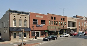
An image of Glasgow
More city maps of Kentucky:
- Map of Mayfield
Mayfield is a city in the western part of Kentucky with 10 thousand inhabitants. It is the county ... - Map of Georgetown
Georgetown, Kentucky is a remarkable city located in Scott County, about 13 miles north to Lexingt... - Map of Hopkinsville
Hopkinsville is a nice city in Kentucky, the county seat of Hopkins County. Hopkinsville is popula... - Map of Paducah
Paducah, Kentucky is a remarkable city located in McCracken County, on the southern bank of Ohio R... - Map of Winchester
Winchester, Kentucky is a nice city and the county seat of Clark County. Winchester is populated n... - Map of Murray
Murray, Kentucky is an excellent city located in Calloway County. The total population of Murray e... - Map of Somerset
Somerset is a city located in Pulaski County, Kentucky. It stands in the south-central part of the... - Map of Versailles
Versailles, Kentucky is a pleasant city located in Woodford County. It stands in the heart of the ... - Map of Franklin
Franklin, Kentucky is a beautiful city located in the southwestern part the state. It is the count... - Map of Middlesborough
Middlesborough is a beautiful city located in Bell County, southeastern Kentucky, near the borders... - Map of Edgewood
Edgewood is a city found in Kenton County, in the northern part of Kentucky. It is part of the Cin... - Map of Mount Sterling
Mount Sterling, Kentucky is an adorable city located in Montgomery County. It stands in the easter... - Map of Vine Grove
Vine Grove, Kentucky is a beautiful city located in Hardin County. It stands in the central part o... - Map of Lebanon
Lebanon, Kentucky is a shining city that serves as the county seat of Marion County. It is situate... - Map of Princeton
Princeton, Kentucky is a wonderful city and the county seat of Caldwell County in the western part... - Map of Dayton
Dayton, Kentucky is a pleasant city located in Campbell County. It is part of the Cincinnati metro... - Map of Williamsburg
Williamsburg, Kentucky is a charming city situated in Whitley County. It is known for being home t...
Distances from Glasgow, Kentucky:
- Distance between Glasgow and Mayfield
- Distance between Glasgow and Georgetown
- Distance between Glasgow and Hopkinsville
- Distance between Glasgow and Paducah
- Distance between Glasgow and Winchester
- Distance between Glasgow and Murray
- Distance between Glasgow and Somerset
- Distance between Glasgow and Versailles
- Distance between Glasgow and Franklin
- Distance between Glasgow and Middlesborough
- Distance between Glasgow and Edgewood
- Distance between Glasgow and Mount Sterling
- Distance between Glasgow and Vine Grove
- Distance between Glasgow and Lebanon
- Distance between Glasgow and Princeton
- Distance between Glasgow and Dayton
- Distance between Glasgow and Williamsburg
Full list of Kentucky maps
This online map of Glasgow, Kentucky is provided by Bing Maps. Please add a bookmark and share the page with your friends!