The exact coordinates of Henderson Kentucky for your GPS track:
Latitude 37.839401 North, Longitude 87.588234 West.
Please share the link with friends and neighbors:
Share on Facebook
Share on WhatsApp
Share on Telegram
Share on Facebook
Share on WhatsApp
Share on Telegram
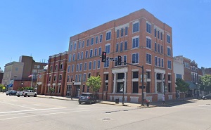
An image of Henderson
More city maps of Kentucky:
- Map of Lexington
Lexington is a city located in the central part of the state of Kentucky, in the United States. It... - Map of Covington
Covington, incorporated in 1815, is a city on the northern edge of Kentucky. It stands upon Ohio r... - Map of Nicholasville
Nicholasville, Kentucky is the county seat of Jessamine County. The total population of Nicholasv... - Map of Madisonville
Madisonville, Kentucky is the county seat of Hopkins County. The total population of Madisonville ... - Map of Shelbyville
Shelbyville, Kentucky is a beautiful city and the county seat of Shelby County. Shelbyville is hom... - Map of Berea
Berea, Kentucky is a charming city found in Madison County. It stands in the central part of the s... - Map of Fort Campbell North
Fort Campbell North is a census-designated place (CDP) located in Christian County, Kentucky. It i... - Map of Paris
Paris, Kentucky is an adorable city situated in Bourbon County. It sits in the northeastern part o... - Map of Elsmere
Elsmere, Kentucky is a charming city found in Kenton County. It is part of the Cincinnati metropol... - Map of Fort Mitchell
Fort Mitchell, Kentucky is a beautiful city located in Kenton County, in the northern part of the ... - Map of London
London, Kentucky is a shining city in Laurel County. It is situated in the Cumberland Plateau of K... - Map of Flatwoods
Flatwoods, Kentucky is a wonderful city found in Greenup County. It is part of the Huntington-Ashl... - Map of Cynthiana
Cynthiana, Kentucky is the county seat of Harrison County. The city is situated in the northern pa... - Map of Crestwood
Crestwood, Kentucky is a city located in Oldham County. It situated northeast of Louisville and is... - Map of Monticello
Monticello, Kentucky is an adorable city that serves as the county seat of Wayne County. The city ... - Map of Douglass Hills
Douglass Hills, Kentucky is a lovely city found in Jefferson County. It's situated to the east of ...
Distances from Henderson, Kentucky:
- Distance between Henderson and Lexington
- Distance between Henderson and Covington
- Distance between Henderson and Nicholasville
- Distance between Henderson and Madisonville
- Distance between Henderson and Shelbyville
- Distance between Henderson and Berea
- Distance between Henderson and Fort Campbell North
- Distance between Henderson and Paris
- Distance between Henderson and Elsmere
- Distance between Henderson and Fort Mitchell
- Distance between Henderson and London
- Distance between Henderson and Flatwoods
- Distance between Henderson and Cynthiana
- Distance between Henderson and Crestwood
- Distance between Henderson and Monticello
- Distance between Henderson and Douglass Hills
Full list of Kentucky maps
This online map of Henderson, Kentucky is provided by Bing Maps. Please add a bookmark and share the page with your friends!