The exact coordinates of Oak Grove Kentucky for your GPS track:
Latitude 36.667187 North, Longitude 87.418114 West.
Share on Facebook
Share on WhatsApp
Share on Telegram
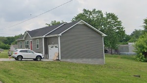
An image of Oak Grove

More city maps of Kentucky:
- Map of Bowling Green
Bowling Green is a city in Warren County, Kentucky. It is the third most populous city in the stat... - Map of Louisville
Louisville is the largest city in the state of Kentucky and home for KFC headquarters. Louisville ... - Map of Richmond
Richmond, Kentucky is a beautiful city and the county seat of Madison County. The total populatio... - Map of Independence
Independence, Kentucky is a positive suburban city located in Kenton County, about 14 miles south ... - Map of Radcliff
Radcliff, Kentucky is a beautiful city situated in Hardin County, about 40 miles south to Louisvil... - Map of Mount Washington
Mount Washington, Kentucky is a positive suburban city of Louisville located in Bullitt County. Mo... - Map of Fort Thomas
Fort Thomas, Kentucky is a shining city located in Campbell County. It stands in the northern part... - Map of Newport
Newport, Kentucky is an adorable city located in Campbell County. It stands along the Ohio River, ... - Map of Lawrenceburg
Lawrenceburg, Kentucky is a lovely city situated in Anderson County. It stands in the central part... - Map of Alexandria
Alexandria, Kentucky is a shining city found in Campbell County. It sits in the northern part of t... - Map of Oakbrook
Oakbrook, Kentucky is a CDP located in Boone County. It is a part of Cincinnati metro area. This s... - Map of Fort Knox
Fort Knox is a United States Army post in Kentucky, located in Meade County, south of Louisville a... - Map of Villa Hills
Villa Hills is a city in Kenton County, in northern Kentucky. It is part of the Cincinnati Metropo... - Map of Taylor Mill
Taylor Mill is a city found in Kenton County in northern Kentucky. It is part of the Cincinnati me... - Map of Leitchfield
Leitchfield, Kentucky is an adorable city that serves as the county seat of Grayson County. It is ... - Map of Wilmore
Wilmore, Kentucky is a lovely city situated in Jessamine County. It is known for being home to Asb... - Map of Bellevue
Bellevue, Kentucky is a beautiful city found in Campbell County. It is part of the Cincinnati metr...
Full list of Kentucky maps
This online map of Oak Grove, Kentucky is provided by Bing Maps. Please add a bookmark and share the page with your friends!
