The exact coordinates of Kenner Louisiana for your GPS track:
Latitude 30 North, Longitude 90.239998 West.
Please share the link with friends and neighbors:
Share on Facebook
Share on WhatsApp
Share on Telegram
Share on Facebook
Share on WhatsApp
Share on Telegram
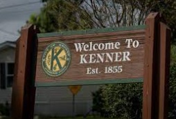
An image of Kenner
More city maps of Louisiana:
- Map of Baton Rouge
Baton Rouge is the capital city of the state of Louisiana and the parish seat of East Baton Rouge ... - Map of Laplace
Laplace, Louisiana is a dynamic CDP located 30 miles west of New Orleans, in St. John the Baptist ... - Map of Ruston
Ruston, Louisiana is an adorable city, parish seat of Lincoln Parish. Ruston is home to 22 thousan... - Map of Zachary
Zachary, Louisiana is a lovely city situated 15 miles north of Baton Rouge. Incorporated on August... - Map of Hammond
Hammond, Louisiana is a shining city located in Tangipahoa Parish, about 45 miles east of Baton Ro... - Map of Thibodaux
Thibodaux, Louisiana is a lovely city located in Lafourche Parish. It stands in the southeastern p... - Map of Claiborne
Claiborne, Louisiana is a lovely CDP located in Ouachita Parish, just 5 miles west of Monroe. Toda... - Map of Mandeville
Mandeville is a city located in St. Tammany Parish, Louisiana. It stands on the northern shore of ... - Map of Crowley
Crowley is a shining city located in Acadia Parish in southwestern Louisiana. It's known for its a... - Map of Abbeville
Abbeville is a city located in Vermilion Parish in southwestern Louisiana. It stands not far from ... - Map of Gardere
Gardere is a wonderful community located in East Baton Rouge Parish in southeastern Louisiana. It ... - Map of DeRidder
DeRidder is a pleasant city located in Beauregard Parish in the southwestern part of Louisiana. It... - Map of Eunice
Eunice is a lovely city located in St. Landry Parish, southwestern Louisiana, in the Acadiana regi... - Map of Village St. George
Village St. George, Louisiana is a census-designated place in East Baton Rouge Parish. It stands ... - Map of Prien
Prien, Louisiana is an adorable community and a CDP located in Calcasieu Parish. It is situated in... - Map of Red Chute
Red Chute, Louisiana is a lovely CDP found in Bossier Parish. It stands in the northern part of t... - Map of Rayne
Rayne, Louisiana is a lovely city located in Acadia Parish. It stands in the southwestern part of ...
Distances from Kenner, Louisiana:
- Distance between Kenner and Baton Rouge
- Distance between Kenner and Laplace
- Distance between Kenner and Ruston
- Distance between Kenner and Zachary
- Distance between Kenner and Hammond
- Distance between Kenner and Thibodaux
- Distance between Kenner and Claiborne
- Distance between Kenner and Mandeville
- Distance between Kenner and Crowley
- Distance between Kenner and Abbeville
- Distance between Kenner and Gardere
- Distance between Kenner and DeRidder
- Distance between Kenner and Eunice
- Distance between Kenner and Village St. George
- Distance between Kenner and Prien
- Distance between Kenner and Red Chute
- Distance between Kenner and Rayne
Full list of Louisiana maps
This online map of Kenner, Louisiana is provided by Bing Maps. Please add a bookmark and share the page with your friends!